North Yorkshire, Sept 2012

This summer’s tourism is more generally Neolithic than specifically Megalithic, and closer to home than Spring’s sojourn to the Mediterranean. I am in North Yorkshire – staying in a little cottage in Helmsley – and have hippy rock musician Julian Cope’s ‘Modern Antiquarian’ (1998) with me, along with Teeside Archaeological Society’s Brian Smith and Alan Walker’s excellent ‘Rock Art & Ritual’ (2008) all about the unique Neolithic Rock Art of the North Yorks Moors, and Durham Archaeology Professor Chris Scarre’s ‘Megalithic Monuments of Britain and Ireland’ (2007) for more general reference. I also have OS Landranger Maps 94, 99, 100, and 101, and GoogleMaps and the OS Maps on my iPhone4S, along with its compass and excellent camera!

The first visit – being in Helmsley – was of course to walk the couple of miles up the Cleveland Way to the picturesque ruins of Rievaulx Abbey, Britain’s first Cistercian institution, from 1132 CE.
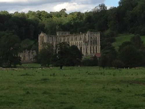
Rievaulx Abbey ruins from the Cleveland Way

A truly idyllic valley, it is little wonder that some six centuries later, the 17th century Fred Goodwin, Charles Dunscombe, upon acquiring the Helmsley estate (complete with ruined Norman castle at Helmsley as well as the ruined Abbey) should decide, not only to build the rather over-the-top Dunscombe Park country house, but to splash out on the then avant garde new-fangled ‘natural’ landscape garden known as Rievaulx Terrace, with its Tuscan and Ionic Temples, and its multiple vistas looking down onto the ruins of the Abbey. A really lovely place, this – you can imagine the late 17th/early 18th century posh-types promenading along here and taking Sunday lunch – apparently twice a year – in the Ionic Temple, built in Roman style but with Greek mythological stories painted on the ceiling. Its a giant fridge magnet proving to all who care to visit that Charles Dunscombe – commoner made good through the (then relatively) new wonders of modern banking – had been on the Grand Tour and seen where the Classics came from. His son married into blue blood and the family added a title to their conspicuous wealth.
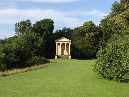
Stunningly beautiful Regency earthworks - with neo-Ionic Temple

But of course the main reasons to be in North Yorkshire are Neolithic: specifically the two sacred landscapes to the West and to the Southeast of the Moors, and the numerous sites – and in particular the rock art – up on the heights of the Moors themselves.
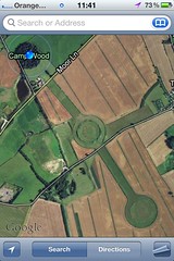
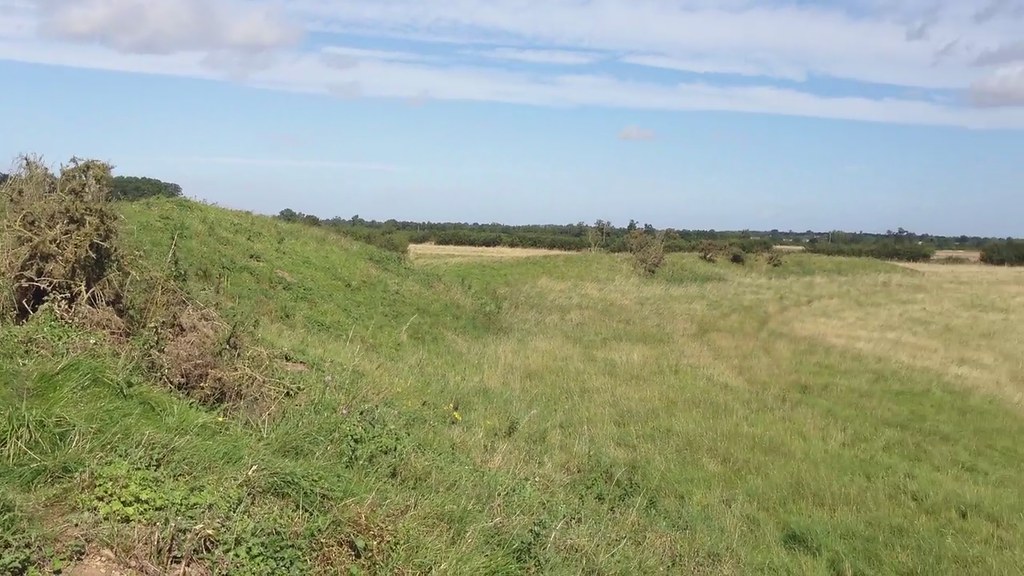
Thornborough Henge 1 - north, Camp WoodThe sacred landscape to the West is the plateau of land between the Rivers Ure and Swale, roughly between Northallerton in the north and Ripon in the South. Cope’s book tells the story well and I refer the reader to his account for more detail. [I also refer you to the Friends of Thornborough website – in particular to news of a fresh application to quarry up to the edge of the site!] My own visit focussed upon two sites – the Thornborough Henges in the north, and the Devil’s Arrows in the south. Both these sites have survived the ravages of time only barely. As Scarre asserts, henges are Late Neolithic (3rd millenium BCE) cousins of cursus monuments, stone and timber circles, and stone rows, where the high bank is usually outside the ditch (unlike Stonehenge, which is both a henge and a stone circle, and where the bank is inside the ditch). Henge, therefore, is not the best word, frankly, but we’re stuck with it. These monuments are not numerous, possibly because they are quite easily ploughed out of existence by farmers who’d rather not plough round them.
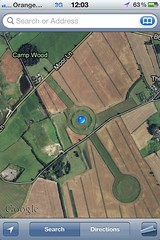
Thornborough Henge 2 - central
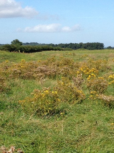
The three Thornborough Henges are in a row, roughly Northwest to Southeast, and the best preserved is the one that is forested over – called Camp Wood. The next best is the central monument, whose outer bank has collapsed in several places, but which still rises here and there to a good height. The cursus monument – probably earlier than the henge – that runs across the southern edge of the central henge, is all but indistinguishable from the modern landscape – I think the single track tarmaced road probably runs along it. The southernmost henge is inaccessible unless you’re happy to walk through a field full of young bulls, or walk around it until you find one of the small breaks in the hedge where there is a white tube covering the top line of barbed wire where you can climb over. It is very depleted by the ravages of time.
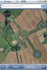
Thornborough Henge 3 - south The incessant beeping of trucks at the gravel pit described by Cope in the 1990s is no more – indeed the gravel pits are now reclaimed as a nature reserve a little way down Moor Lane that includes a useful car park where you can leave your car before exploring the three monuments. Visiting all three is a must – you get a clear idea of the depth of the ditch and height of the bank (and width of the top of the bank) in Camp Wood, and, without the tree cover, a good idea of the scale and grandeur of the henges in the central monument. From the southern henge, you can look north back across the tops of the highest surviving ridges of the bank around the central monument to the trees of Camp Wood in the north and get a real feel for how the three monuments may have worked together in the past, with a Processional Way of some kind linking the three, no doubt, though no sign beyond field boundaries remains of such a Way, that I could ascertain.
Untitled

View of central and northern wooded henge from southern Thornborough Henge

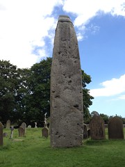
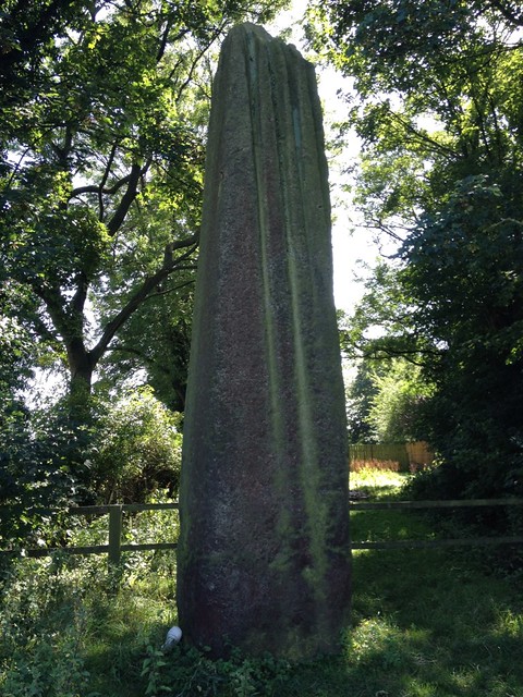
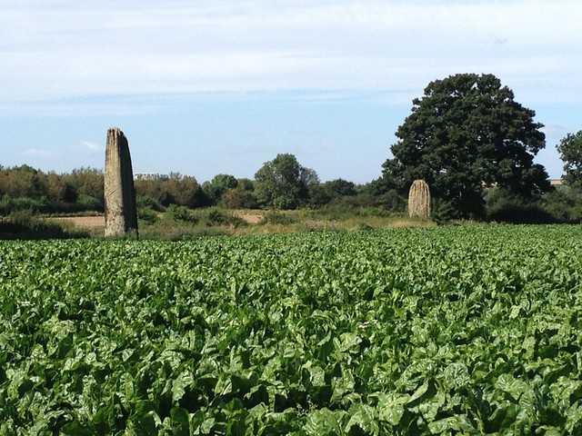
Satisfied with my visit to the henges – a good two hours of clambering that made me grateful for my boots and long trousers, despite the heat of the late summer – I made next for Boroughbridge, a small town a short way down the A1(M) from Thornborough. As Cope describes so vividly, this dead-straight Roman road completely cuts through this landscape, and in its modern motorway form cuts one off from the surrounding landscape too, as you drive from junction to junction. But there is worse to come. Arriving at Boroughbridge you discover just how completely an ancient sacred monument can be disrespected in the modern era. The three Devil’s Arrows – a row of three supremely tall monuments of grit stone, scored by rainwater in great deep scratches from summit to base – are separated by the road, which cuts through them right next to the northernmost, and tallest, stone. The other side of the road, behind a tall hedge, the two remaining stones are completely inaccessible in the midst of a large field of cabbages. Heartbreakingly desolate, this ancient sacred site is quite desecrated, and after the briefest of visits I pressed on, eager to leave the place as soon as possible. Very sad.
Untitled

Untitled

Untitled

The sacred landscape to the Southeast of the Moors has, I’m sorry to say, faired only a little better. The centrepiece is the largest monolith in Britain, the Rudston Monolith, erected on a natural mound c2000 BCE, and rising over 26ft in height, today capped with iron to stop it eroding. Around it stands the graveyard of a Norman church – Rudston’s All Saints Parish Church. Yet in the landscape of four thousand years ago there are no less than four cursus monuments – including the 2.5mile long Argham Cursus – that meet here at Rudston, along the little rivulet the Gypsey Race. Nearby are a number of ancient Howes – the finest outside of Wiltshire – including Willy Howe, where amidst the bracken and undergrowth of the tree covered mound I found a ‘Whiteleafed’ thorn tree, and added a strip of my handkerchief as a little offering to the tree, the Howe, and the landscape around. It was truly heartening to see that this Howe is not only visited, but clearly frequented by other Pagan-minded people who partake in one of the most ancient of customs – the making of Whiteleafed trees.
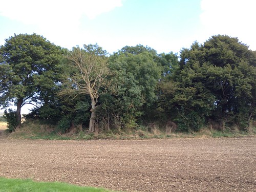
Willy Howe

This concluded my visits to the two sacred Neolithic landscapes around the Moors. I couldn’t resist, however, whilst here, a few miles of the Wolds Way, and a glimpse of the Iron Age earthworks that comprise Camp Dale. Heavily agricultural now, the area is difficult to access beyond the bounds of the path, and the Camp itself inaccessible, but the earthworks remain, nonetheless, impressive! Tomorrow – the Moors themselves!

Earthworks at Camp Dale, from the Wolds Way

Corsica, May 2012

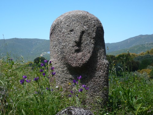
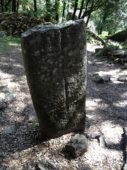
Statue-menhir at Capula Wednesday was my trip through the heart of Corsica, taking in the Bronze Age sites of Cucuruzzu and Capula: the former rather dull, in all honesty, the latter re-occupied in the Middle Ages by Count Bianco, who ruled the whole of southern Corsica from here, leaving barely any trace of the earlier Bronze Age site save a single statue-menhir now reconstituted and erected at the entrance.

Mesolithic Corsica The Prehistoric Museum at Levie was well worth it – a regional museum with artefacts from Cucuruzzu and Capula and other sites around the south of the island, including the Dame de Bonifacio – a 35yr old disabled woman from 10000BCE. It became really clear here how the islands of Corsica and Sardinia were once one massive lump of granite – originally part of the Pyrenees – which had moved gradually across the western Mediterranean only reaching its current location as recently at 9500BCE – a blink of an eye in geological time. To repeat from the last post, not only all the obsidian found on Corsica came from Sardinia, where the main obsidian mine for much of Europe is found; there aren’t any metal ores on Corsica either, so all the bronze – all the swords and daggers on the statue-menhirs – came from Sardinia, too.

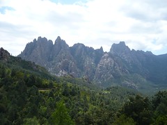
Col de Bavella From Levie the drive up through Zonza takes you past the Col de Bavella, the immense peak of the southern part of the island, like a punk haircut in ancient stone, riven by the ravages of time and erosion into the weirdest of shapes: the ‘Quarry’ at Filitosa but on an epic scale! The drive down the east of the island from there gives continuous glimpses of the most lovely of beaches, before the road turns inland again toward Porto Vecchio. Wishing to avoid this most touristy of towns, I climbed up to the mountaintop of Casteddu d’Araghju (quite a climb in the afternoon heat, I can tell you) to the Bronze Age Nuraghic-like ruins there, before heading back across country to Sartene, through the smaller villages back up to Levie and back down the winding road to my little gite.

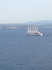
From Bonifacio, Club Med in the foreground, Sardinia in the background Thursday, like Tuesday, was a quieter day for relaxation, but I did take in the lovely seaside town of Bonifacio in the early evening, stopping at the delightful Terrasses d’Aragon restaurant, where the food was every bit as good as the view, (despite the complaints of fussy eaters on Trip Advisor) and I was able to marvel at the short strait that divides Corsica and Sardinia – perhaps a teensy bit wider than the Menai Straits, and certainly too wide for a bridge, but much much closer than France is to Britain, which of course was also a walkable landmass at the same time, when mesolithic hunters peopled Europe.

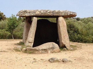
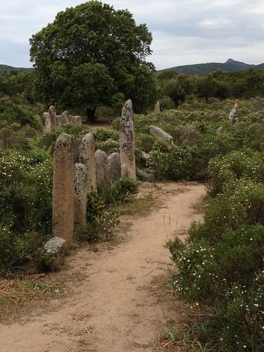
Today – Friday – I have seen the megalithic site that makes the holiday, for me. Filitosa, as my last post I think made clear, was far too ‘interpreted’ for me. Today, after visiting the small alignment of Stantari, the slightly larger grouping/alignment of Renaghju, and the ‘poster boy’ dolmen of Corsica: Fontanaccia, all thankfully left fairly well alone, (albeit along a well signed, well fenced tourist walk), I struggled across fields up and down a long and winding dirt path with no signage – unsure I was even going the right way, though trusting the excitement in my heart – to the barely touched, mostly recumbent, weed strangled Alignements de Pagliaju.

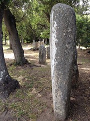
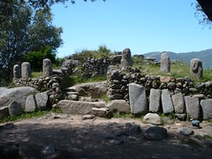
Stantari Stantari had (at least) two of the later, Bronze Age (c2000BCE here) statue-menhirs, with their proud phallic heads and stony faced looks, standing slightly taller and narrower than their rough hewn neighbours. This made me think, strangely, of the Celtic Crosses in the Hebrides, which I had always thought were probably remodelled standing stones, the new religion recycling the monuments of the old. Here it was again – though in this case c3000BCE monuments remodelled in c2000-1800BCE. There seems some disagreement on the web about whether all of the menhirs in this particular alignment are statue-menhirs or just the two. To my eye, there were only the two, amongst rough-hewn others. But as the whole site was fenced off with barbed wire it was impossible to get close enough to really tell.

Ranaghju Renaghju, not fenced off, about 5mins walk down the path, was definitely all rough hewn – supporting my feeling that the statue-menhirs were later remodellings at Stantari. There seemed to be a number of alignments with nearby hilltops, in particular with the characteristic Corsican rocky outcrops shaped by erosion into weird and wonderful and eerie faces, animals, and rock-spirits. The alignments were however either very complex or the re-erection of stones quite haphazard.

Dolmen de Fontanaccia Third in the circuit was the Dolmen de Fontanaccia, pictures of which I have seen everywhere in Corsica – hence me dubbing it the ‘poster boy’ of Corsican prehistory, alongside the most representational of the Filitosan statue-menhirs. All three of these sites, I have to admit, rather lacked atmosphere – that wonderful quality of megalithic sites that captures the imagination. They were all somehow too manicured, albeit far from being over-interpreted like Filitosa. Perhaps I am spoiled by the wonderful Historic Scotland, English Heritage, and National Trust, in the UK, who all do their utmost to protect, conserve, tastefully and almost imperceptibly renovate, and generally if possible leave well alone (with notable exceptions, of course….)

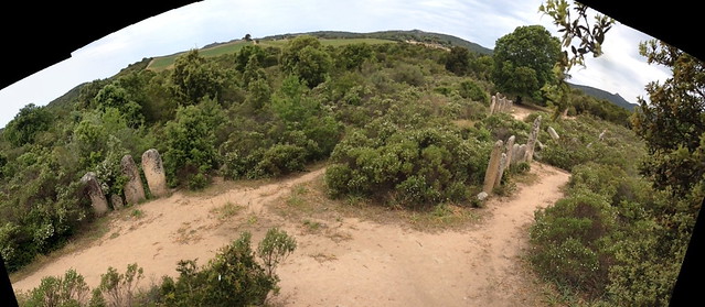
Alignements de Pagliaju But then finally, some 20mins or so further down the road, and situated on private land, with just a short little drive off the main road, blocked off with granite blocks, leaving parking space for only one car between the main road and the blocks, all under a rusting and defaced sign saying ‘Palaggiu’, I began the 15minute walk up into the wilderness, past an empty ruined hilltop farmhouse, with only the odd collection of rocks shaped into an arrow to guide my path (very tasteful I thought), leading finally to a completely rusted sign with an arrow scratched onto it pointing off the main track to what I had gleaned from the map was the site of the Alignements de Pagliaju.

Alignements de Pagliaju with Col de Bavella in the distance The atmosphere here was truly amazing. The stones fair sizzled in the midday heat (as I did!) and for all that many of them were recumbent, those that still stood made clear how the original site seemed to have been laid out. I could discern something of a ‘T’ shape, with the top bar longer than the pillar, if you get me. The pillar seemed aligned with the very far distant peak of the Col de Bavella. There were so many stones in the central main alignment – I would guess originally a double row of stones, similar to that at Callanish – but as most were fallen, tumbled amongst the gorse and weeds, it was difficult to tell if there weren’t here and there single or small groups of stones between the rows, too. The stones in the ‘pillar’ of the ‘T’ were so tumbled, all recumbent in the dust, it was not possible from a short visit such as this to tell if they had even been in a row, though they certainly seemed to extend away from the main lines of stones in a perpendicular direction, roughly in line with the far distant mountain tops.

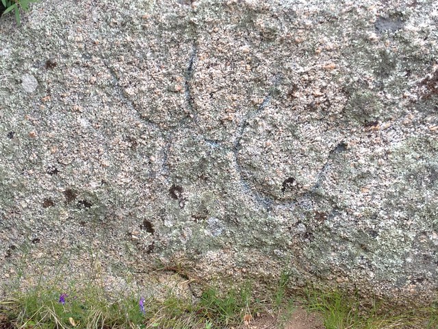
Cairn with cup-and-ring marks at Alignements de Pagliaju Over to one end was a group of massive granite blocks (such a frequent sight here) which I could climb to get something of an overview. Behind the blocks, seemingly at the entrance to the site, were the remains of a cairn, I don’t know whether contemporary or later than the alignments, that seemed to include internal cup-and-ring marks.

I spent over an hour here, in the baking heat, wandering amongst these enigmatic stones, thankful to the owner for leaving well alone and making it quite hard to reach, alone with the ancients.

Palaghju panorama

Orkney and Corsica May 2012

It’s turning out to be quite a month for megalithic tourism!

Skara Brae I am blogging today from Corsica, that island in the Mediterranean to the north of Sardinia, with Italy to the east (to which Sardinia belongs) and France to the north, (to which Corsica belongs.) Both islands have indigenous languages older than Italian and French, and the road signs in both are bilingual. But the Sardinians speak several languages, and here in Corsica French is definitely uppermost.  The islands were of course one large island, until the retreat of the last ice age and rise of sea level circa 8000 BC.

Anyway – before I tell you about my (solo) travels in Corsica, I must tell you what I was up to last weekend! For the May full-moon weekend, I drove to Orkney. [I’ll post some more pics here soon – WordPress is having trouble with pictures at present – a problem with the new server, I’m sorry to say – so these links to Flickr will have to suffice for now : Orkney Pics on Flickr]

It’s a nine-and-a-half hour drive from Manchester to Thurso, the little town on the very north coast of Scotland from where one takes the ferry to Orkney. Fortunately, after a busy week, I had with me trusted old friend and fellow traveller on various megalithic excursions (including the Isles of Scilly), Alan Slee, to share the driving. Leaving central Manchester at 7.30am, stopping for coffee once late morning and for lunch at the House of Bruar (an excellent and recommended stopover), we arrived in Thurso at about 6pm and stayed over at the Royal Hotel. It can’t be said that Thurso is a particularly thriving town, or that its 3* hotel was especially well appointed. The Station Hotel offered the better menu, and we supped there – the Cullen Skink being particularly good!

The 8.45am ferry from Stromness Harbour to Scrabster on mainland Orkney rolled rather threateningly in high seas for the first 30 of the 90 minute journey, but was soon in more settled waters and landed us safely where we could at last drive out of the ro-ro and onto the island, and head for our cottage for the weekend. I have rented a good number of self-catering cottages in the UK, some old, some new, some large, some small, but I have to say this one was one of the very best, ever: warm, cosy, a superbly well kitted out kitchen, lovely bathrooms – all in all an excellent place: Unigar cottages – highly recommended. Exhausted from our epic journey of Thursday, we achieved little more than shopping on Friday, stopping off at Rennibister Earth House on the way – appropriately enough a neolithic store house – and scrumping for mussels and limpets on a beach of the Bay of Firth to soak in salt water overnight for a seafood soup the following day.

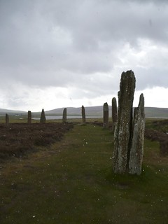
Ring of Brodgar The truly ‘epic’ day, however, was Saturday, when we took in the Heart of the Neolithic Orkney World Heritage Site, comprising the Ring of Brodgar, the Stones of Stenness, Maeshowe Burial Chamber, and the neolithic village of Skara Brae. We rose early and went straight to the Ring of the Brodgar, arriving first before any other tourists, and were fortunate enough to have the site to ourselves. Once sporting 60 stones, this is quite simply one of the most impressive stone circles I have ever seen (and I’ve seen a few!) The central area is covered in heather and the signs clearly require visitors to keep to the path around the perimeter within the circle of stones. But the stones themselves are all so individual, so fascinating, that there is plenty to immerse oneself in without the desire to venture into the centre. The weathering of thousands of years is all too apparent on many of the stones, but the sense of mystery and awe seemed accentuated by the inclement weather that soon blew in from the Atlantic, bringing at one point a shower of hail to cloud up the lenses on our cameras. We completed the circuit just in time before the next tourists arrived at the circle, and as we left, gathered a few marsh marigolds to add to our lunchtime salad – a foraging delicacy plentiful in these parts.

From the Ring it is but a few moments drive down the Ness of Brodgar, past the site of the excavations where a Neolithic Temple – some say a kind of Neolithic Hogwarts – is being unearthed. The archaeological site is only open for tours during digging, for six weeks each summer, so all we could glimpse was the black plastic sheeting covering proceedings. What may have transpired in this temple, further excavation may yet give tantalising hints at. Leaving it for another year, we continued across the Ness to the Watchstone, and on across the bridge (reputedly in place for thousands of years) to the Stones of Stenness.

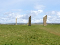
Stones of Stenness The Stones of Stenness is an amazing circle. Once twelve stones – (one has to wonder whether there might be some sexagesimal significance to the 60 stones of the Ring of the Brodgar and the 12 of the later Stones of Stenness?) – there is an aura of majesty around the tall and imposing stones that the Ring, with its smaller and more weathered stones, somehow lacked. The Stones of Stenness feels more like a grand chapel for the mighty, compared to the cathedral-for-all at the Ring of Brodgar. Behind it, at the Barnhouse ‘village’ site, one feels rather in the lodgings of a priesthood that ministered at Stenness, like the cells of an abbey, and one can almost envisage grand ceremonies undertaken by the elect at Stenness for vast geo-political strategems, by the monkish inhabitants of Barnhouse, alongside more prosaic public ceremonials for the masses undertaken at the Ring of Brodgar. In between, secret preparations and initiations in the Temple of the Ness prepared the priesthood for their labours.

Such imaginings are perhaps merely fanciful, yet in truth even the interpretations of the most knowledgeable of archaeologists are often little better. I rely a great deal upon the careful work of archaeologists but confess I rarely take their ideas of what life and ritual were like thousands of years ago without a good helping of salt. It is only a decade or so since even the idea of archaeo-astronomy – the alignment of Neolithic sites with solar and lunar risings and settings at various times of the year – became anything less than New Age rubbish as far as professional archaeologists were concerned. It is now broadly accepted orthodoxy across Europe. Stellar alignments of course remain very hard to gauge, as the night sky moves inexorably with the precession of the equinoxes, and what may have been true in 1500BC is yards off today. But – complex though their movements are – the sun and moon rise and set today pretty much exactly where they did 5000 years ago – give or take a few inches – and at Maeshowe, in particular, the Winter Solstice still lights up the inside of the chamber with startling accuracy. This chamber, built with four standing stones at its corners, and three more, shorter, stubby ones each immediately below the openings in the sides of the chamber allowing access to sub chambers, and all completed with the most amazing and enduring masonry in between, is quite literally the most accomplished feat of Neolithic masonry I have ever seen. Certainly more accomplished than Newgrange, for all the marvels of its corbelled roof, which I visited in 1996. Certainly more accomplished than the temples of Malta, where I visited in 2008, for all their gigantic size. Certainly squarer and more precise than the chambered tombs of Jersey (Apr 2009) and of the Isles of Scilly (Aug 2009). I was really quite stunned. This was masonry on a par with the Egyptians (March 2007): and they were later. And there is no evidence of any burial in this chambered cairn – only some tale of human and horse bones that were mysteriously ‘lost’ by the Victorian antiquarian who ‘found’ them in the cairn. The mystery of what this place was really for, remains.

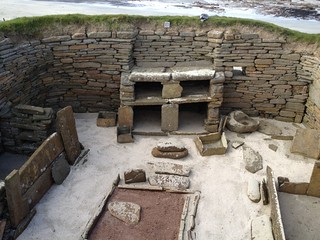
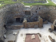
Skara Brae Finally then, to cap an already amazing day, to the village where the people who worshipped at these great temples actually lived: Skara Brae. The wonder of this place is not so much in the finery of its furnishings, the layout of its dwellings…. all these seem, somehow, so natural, so thoroughly familiar. The wonder is that they have been dated to 3100BC. That’s contemporary with the temples on Malta – complete with strikingly similar stone dressers! The wonder is that they have survived at all. The reason? On Orkney, already by the time of the Neolithic people who began farming here in the late 4th millenium BCE, there were no trees here. Mesolithic man had long ago cut them all down. So the village – like the temples – was made out of stone.

Yesterday, in Corsica, at Filitosa, [see the pics on Flickr here Corsica pics on Flickr] I discovered another of these extraordinary archaeological/environmental cross-overs. Remember the Bronze Age warriors of the 2nd millenium BCE whose little metal statuettes are so common on Sardinia (Apr 2011), the island to the south where the Nuraghe were built? Well it seems that here on Corsica, where not only the absence of any obsidian meant it had to have been imported from the southern island, (from where most of Europe’s Neolithic obsidian haled) but also the lack of any metal ores, meant that the statuary of Corsica had to be in done not in bronze, like their southern cousins did, but in stone. So here, in Corsica, almost unique in all of Europe, one can witness the phenomenon of the statue-menhir – megalithic menhirs that, in the Bronze Age, were carved in the likeness of fierce warriors, brandishing swords and daggers – the latter undoubtedly imported from the neighbouring island to the south.

The weekend in Orkney ended on the Sunday, with a visit to the southernmost island of the Orkney archipelago (all one great island in Neolithic times, as were the Isles of Scilly, and islands of Corsica and Sardinia), South Ronaldsay, accessible over a series of causeways that link it, via a couple of small islets, to the mainland of Orkney, and, on its southernmost coast, the Tomb of the Eagles – a chambered cairn entered through a very low passage on a large skateboard. The roof was completely new, concrete, yet the aura of the place didn’t suffer too much from this reconstruction, and the skulls in one of the chambers set the place off as a truly eerie burial chamber, quite unlike the experience at Maeshowe. It must be said, however, that the private management of this site was not a patch on the professionalism of Historic Scotland at the World Heritage Site. Monday, all day, I drove, and drove, and drove….

Then on the following Sunday, an aeroplane, landing at Ajaccio, and a hire car down to a little gite near Sartene – not a patch on Unigar but sufficient for my needs, and Monday, the crown-jewel of Corsica’s prehistoric monuments, Filitosa – an extraordinary experience indeed.

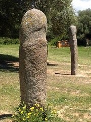
Fliltosa Filitosa is a large and fascinating complex. There is evidence of several thousand years of occupation here, from the Mesolithic, through the Neolithic and Megalithic, and on into the Bronze Age. The rough-hewn menhirs familiar to the rest of Europe, and contemporary with the megalithic era in Malta (Mar 2008), and Portugal (July 2007), are in evidence, but much more striking are the later, Bronze Age statue-menhirs, carved menhirs that resemble both huge stone phalli and statues of warriors. two of the five tall statue-menhirs at Filitosa To my eye both are implied by the artists who created these amazing works of prehistoric art, between three and four thousand years ago. The warriors they represent, resplendent in their armour, with their daggers and swords, wear helmets every bit as phallic as they look, and the statues are monuments to the virility of the warriors and to the fertility of their power. There is only oblique mention of the phallic symbology in the guidebook, in this Catholic country, but reference is inescapable.

Central Monument at Filitosa The interpretive work undertaken by the landowner and the Corsican authorities has resulted in some slightly deceptive placements. The six small statue-menhirs on the central monument are the broken upper-halves of once taller statues-menhirs that were incorporated into the spherical dome-like structure built over the top of the end of the spur by Nuraghic-era people occupying the site later than the creators of the statue-menhirs. The Western monument, below the Central Monument, is very Nuraghic indeed, bringing my trip last year to Sardinia strongly to mind. The grouping of the five tall statue-menhirs by the tree below the spur is clearly recent rather than historic. In truth what is visible now is (necessarily) a melange of several different periods of occupation overlain with late-20th century interpretation and reconstruction. By far the worst part of this muddle, however, is the placement of small plastic installations emitting quite horrid ‘mood-music’ here and there around the bluff, in between narrative descriptions. These, along with the regular, taller, metallic ‘interpretation stations’ with buttons for different languages – which unfortunately do not offer an ‘off’ button – turn this central area of the site into a kind of outdoor museum, neither one nor the other, and the French commentary interspersed with the ‘mood-music’ is the permanent default. This I must say I found most off-putting, and it was only at the platform, under the tree above the group of five tall statue-menhirs, that, hands on the stone, with only the whisper of the gentle breeze in my ears, I could in any sense ‘feel’ any of the majesty of the place.

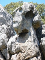
Face in the rock of the Quarry Climbing further up to what they have termed the Quarry, to my eye the most striking sight was the clear face within the rock – far more interesting than the so called ‘dinosaur’ to the rear of the rock formation. Here, indeed, it seemed the Goddess of Stone and Earth looked out across the entire site, with her eerie headdress and staring eye.

The Bronze Age hut foundations, perhaps the dwellings of the carvers of the statue-menhirs, were fenced off, and hard to see – quite a contrast with the Barnhouse or Skara Brae – and clearly insufficiently ‘mysterious’ for the curators of this tourist attraction. I have to say, in the end, that the overlay of interpretation at this site to a certain extent spoiled the experience, certainly when viewed in contrast to sites elsewhere where the interpretation is strictly separate from the site, and relatively unobtrusive, though the reconstructions undertaken by archaeologists are everywhere evident: even the Stones of Stenness had been re-erected from recumbency within the last hundred years.

Nonetheless, the site is well worth the visit, if only to see, and feel the majesty of the extraordinary art-work of the Bronze Age statuary.

Nuraghe

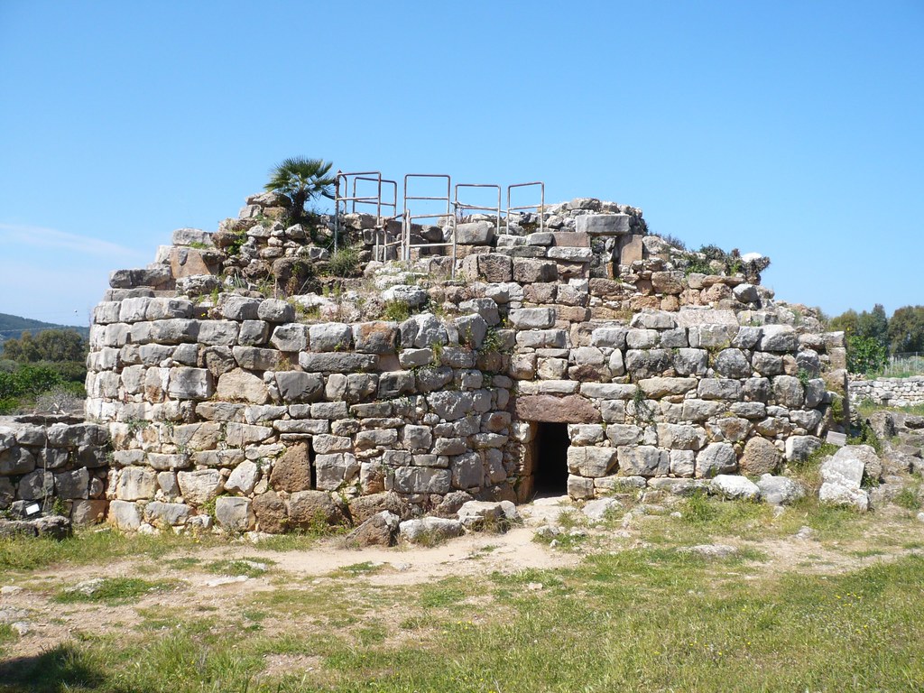
Palmavera Nuraghe, Alghero, Sardinia
Visited a Nuragic tower and settlement today – Palmavera.  Fascinating.  In occupation roughly 1500BC to 900BC.  There are all the hallmarks of the typical Sardinian Nuragic tower, surrounded by huts.  This is a Class II example, with a double central tower rather than the simpler single tower, or the more complex (Class III) multiple tower examples – most of which are in the south.  As usual I have acquired a rather academic archaeological book in advance to read up on the culture in advance, as well as purchasing, today, the book on the site available at the ticket office. The guides seem to assume that the towers were the dwelling places of chiefs, surrounded by the lesser people in their huts.  Even in the article criticising previous attempts to suggest colonisation from the Eastern meditteranean must have been the origin of such comlpex architecture, supporting instead the idea of a developed local megalithic culture, the assumption remains that these towers are the dwellings of chiefs.  Yet everywhere, unexplained, and glossed over, there are miniature models of these towers.  In the huge round ‘meeting hut’ here at Palmavera, (as found elsewhere), where there is a bench all the way round the inside of this largest of all the huts, and a central pedestal, the item on the pedestal, the focus of the meeting, is a model of the tower – yes the one that is just outside this meeting hut.  In all the archaeological digs, little hand-held or window-sill size models of the tower are found from the period.  It strikes me, I have to say, that one hypothesis archaeologists might do well to investigate would be that these towers were not dwelling places at all – at least not of the living!  It strikes me that these towers were ceremonial places, and if utensils have been found there then they may have been offerings, or there may have been feasts in these towers.  Inside, the conical corbelled roof reminded me of Newgrange.

After Palmavera, I cycled on to Anghelu Ruju, an older – pre-Nuragic necropolis with more than twenty tombs, and evidence of multiple burials from the end of the Mesolithic right through the early Neolithic and up to the Nuragic period.  They were hollowed out from what seemed like a limestone shelf, eerie, ancient, sometimes square, sometimes circular, covering many centuries of use and reuse.  In one, there was a doorway at the end of the entrance passage, flanked clearly by crescent-moon like bulls-horn reliefs.  It was a very potent image of the deepest past, and struck me that perhaps these dark, enclosed spaces where the spirits dwelled might indeed, in the Nuragic, have become the heart of the new-style settlements : no longer perhaps specifically burial sites, but the dwelling places of spirits whose cults had begun in the necropolises.  Idle speculation perhaps.  Amateur archaeology, certainly.  But what delightful weather to do it in 🙂

Interesting Update:
See this for some news on the Nuragic culture!

Alghero Limoncello

Interesting day.  Got pulled over last December and fined for speeding on the M60. Had to surrender my licence to be amended and reissued.  Only rememebered on the plane that I hadn’t received the replacement yet – four months later!  So I’m not able to hire the car I reserved with Hertz, and, after a brief warning chat with the Tourist Info point here in Alghero about daring to speak to the Italian police, I am clearly grounded in Alghero, reliant on the scant bus services.  Ah well.  Lots of excellent food and wine shops and an opportunity to cook a pasta di frutti di mare. Yum! Sauteed the polpo (octopus) until tender while I ate the fresh local aspargus – lightly steamed – with garlic butter.  *licks lips*

After dinner I heard a band outside the window of my little studio apartment in the old town and leant out the window to see what was going on.  It was a parade of some sort – with candles, and therefore probably religious. I put my coat on to go downstairs and follow.  The procession, led by the band, included a tall effigy draped in a black cloak – it had to be the Madonna – and was followed by what was clearly mostly local people with a few tourists at the edges.  I joined the locals, and followed them down through the winding streets of the old town and eventually into the church.  I followed two young lads, taller than all their elderly relatives, but seemingly just as devout, right up until they joined some of their peers in a side chapel of the church – I guessed they were teenagers who had been choirboys.

I stood off to one side in the shadows at the side of the church, as the main congregation clustered around the effigy of the Madonna, resplendant in a magnificent cloak, but somehow not that dissimilar from a shop-window dummy in a white dress and black cloak.  As the Latin and the Italian chants around me played themselves out, I thought about Italy as the home of the Roman Catholic Church, of the pride of the Italians in leading a billion or more christians around the world.  I thought of the golden idols that Moses threw down and how he might view the worship of this shop-window dummy of the Madonna.

As the ceremony came to a close I turned, but before leaving picked up a tea-light at one of the many candle-stations and lit it, tracing the pentacle with my finger on my forehead, and saying a little prayer to the (local Sardinian) Goddess, knowing that She was here, thousands of years in the making, regardless of what the priests might say in a language long dead, of a man who died thousands of miles away…

I returned to my little studio, stopping off on the way to buy a bottle of Limoncello, and as it chilled in the freezer, enjoyed the single MonteCristo I bought at the same time, delighting in the joy of being stuck in a little town on a little island in the Med, with nothing to do.  What luxury!

BTW: Despite Sardinia being the home of Tiscali (its President is Tiscali’s CEO or smthg) there is no WiFi anywhere in Alghero, and only 90s style pay-for-10mins access to the internet on slow-as-tractors ancient XP machines in photocopy shops.  So blogging is going to be strictly an iPhone affair. And what a bloody pallaver that is!  Text is easy, but an image???!! Running my own installation of WordPress on my own server, (and I’m not sure that that is the problem, just saying) I cannot add (using my iphone) an image to WordPress from my iPhone (it requires Flash) or, via the URL option, from my me.com gallery OR my flickr gallery (just get a red X – presumably these galleries require signup of some kind.)  Where to put a free access photo then?  Couldn’t FTP anywhere it on international data connection.  Stumped.  So much for Web 2.0!!!

02 fortunately can’t charge me more than £35 for data roaming – up to 50Mb.  Good job considering how many pics of my dinner I’ver sent from my iPhone to various so-called Web2 spaces.  So if I go quiet – you’ll know why!  Any advice welcome!!

[FGAL id=1480]

Peru Trip #12 – Final Thoughts

My Peruvian adventure has been both fascinating and – strangely enough – restful. A change is as good as a rest, so they say, and I have to say that perutourism.com have really done well in escorting me around the country – meeting me everywhere and ensuring I get the buses, trains and planes in my itinerary, picking me up from hotels to take me to train stations, bus stations, and airports, and collecting me from them to transfer me to my new hotel, each time. It has meant the entire holiday has been stress free, as far as making arrangements is concerned – all of that is taken care of. The fact that the vast majority of the time I have had ‘private service’ – a driver, a guide, and me, either in a small minivan or private car – has meant that I’ve had a more personal experience than the description ‘guided tour’ usually implies, able to have a one-to-one with each guide, getting the most out of each place I have visited. Worth every penny – and the exchange rate has really been in my favour: Peru is cheap. And, of course, as my conversations with fellow travellers in the Cusco restaurant and at Intipunku proved, this is the surest way to insulate oneself from the potential downsides of being in a very poor country.

Highlights
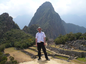
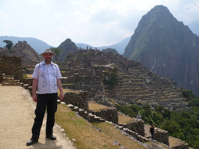
Me at Machu Picchu
The highlights of the trip include, of course, the Lords of Sipan
Museum, which was an extremely well thought out, brilliantly executed,
and fascinating museum, which taught me more about the Moche people than
any other visit; and Machu Picchu, the deserved crown of Peruvian
ancient architecture, unmolested by anything but the jungle for 500
years since it was abandoned, an absolute jewel set in some of the most
stunning scenery I have been fortunate enough to discover. These two
really stand out as the most amazing visits of my trip. But also of
course Huaca de la Luna was an eye-opening masterpiece, too, showing
that the Moche produced all the stunning artwork known so well from
their ceramics, in relief on the walls of their temples, too. I really
enjoyed the extensive collection of Moche ceramics at the Casinelli
Museum, and the Lady of Cao pyramid and museum at El Brujo proved the
Moche had great Queens as well as Kings. I was suitably awe-struck by
the megalithic scale of the Inca architecture at Saqsaywaman, despite
only the foundations remaining, and only 20% of the site open to
tourists, and I really enjoyed the stunning Inca palace at
Ollantaytambo, with its technical wizardry, wonderful location, and
still living streets and squares.

Lowpoints
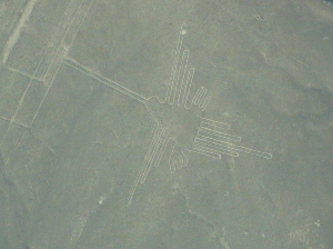
One of the shapes of the Nazca lines
Lowpoints, if there were any, were principally Nazca – I’d say ‘not to
be recommended’, in the end: the discomfort of the experience outweighs
the opportunity to take poorer photographs than one is able to google at
a moment’s notice.

Perhaps to be considered a lowpoint, but also a welcome rest, was my day in bed in Puno trying to breathe at 13000ft!

But probably the only real ‘lowpoint’ as such, was, certainly during my
first few days, that my hip was still giving me grief, and the
associated inability to do much walking, or, later, any serious climbs.
The damage done to my hip through compensation issues related to my
congenital back problem, came about as a result of my ThomasCook
sardine-can trip to Vancouver and back, in June. [KLM to Lima were much
better, and I paid extra for a good seat.] Having been using a stick
as recently as days before departure, and wearing a strap daily right
through the holiday, I am nonetheless grateful that, in the end, this
really did not overly impact upon my Peruvian trip. I was restrained,
cautious, and careful, and it paid off. Only on a couple of occasions
(including the walk to Intipunku) did I really feel I was pushing it,
and, towards the end of this three week adventure (especially on the
walk to Intipunku) my general caution and care seemed to have nurtured
enough healing for me to achieve the things I really wanted. All I
would say that it has cost me (apart from the nuisances associated with
the strap) were: I didn’t climb the pyramid at Tucume; not wanting to
climb Amantani contributed to my decision to stay in bed on my first day
in Puno; and of course Wayna Pichu, the mountain peak overlooking Machu
Picchu, was out of the question, even though, by that point, I was
actually feeling not bad. But only 400 people are allowed up it each
day, and it’s apparently a seriously taxing climb, an absolute no-no for
anyone in my condition. But going to Intipunku, the Sun Gate, instead,
was lovely! The Inca Trail, four days for 20 year olds on gap years or
Uni summer breaks, was clearly exhausting even for those I saw arriving
at Machu Picchu for the dawn, and it’s more than 20 years since I last
walked a long distance for several days in a row.

Irrelevancies
The Church at the village near Chucuito.  The cross out front is the marker of the Inquisition. The dancers are on day four of a wedding celebration
On my New Zealand holiday in 2007 there were quite a few stops arranged
by my travel agent that I really found superfluous (at best) or simply
spurious. I think I had greater control over this tour, with
PeruTourism.com, and managed to keep silly stuff to a minimum.
Nonetheless there were a few things I could’ve foregone on a tour of
ancient Peru: the horse show was definitely the most irrelevant – even
tiresome – hence this being its only mention; the brief stop at the Inca
Bar to drink Chicha was charming but unnecessary; and the half dozen or
so churches I visited that I haven’t even mentioned in this blog. Most
were actually ok, even quite interesting, but only for the syncretistic
incorporation of pre-Columbian symbols and motifs into Peru’s unique
brand of Baroque Catholicism. I have to say that I concur with the
long-held English tradition of anti-papism, and have been struck more
than ever before by how (to use one of their favourite words) ‘evil’ an
institution the Catholic Church is. [Do see Stephen Fry’s wonderful critique of the Catholic Church.]
OK, so the British (with help from the Germans, Irish, French, Belgians
and Dutch) exterminated much of the indigenous population of North
America, and left a poisonous legacy in Africa, the Middle East, and
elsewhere. But the surviving First Nations, in Canada at least, have
managed to keep an unbroken line of tradition going, there; Africa is
proudly reasserting its own culture, and flexing its muscle in the
Anglican family. India is returning to her former glory after the brief
period of colonial nuisance. Here, in South America, following the
vile practices of the Inquisition, 90% of the people are still Catholic,
speak Spanish, and view the darker skinned, more purely indigenous
people who still speak Runisamy (the Quechua language) or Aymara, with
distaste. I knew the British had a lot to answer for around the world.
Now I have seen how much the Spanish have to answer for, too.

Final Thoughts

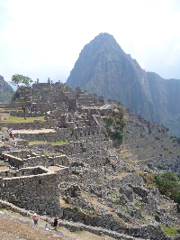
Machu Picchu from Intipunku

Finally, in a sort of sad, geeky kind of way, for a solo traveller in a
foreign country, I have to say that my Mac is my friend. It has given
me Facebook; enabled me to do all this blogging; iPhoto and access to
Flickr have enabled me to process and display all my holiday pics as I
go along; and Hoyles games has wiled away the odd hour of an evening in a
hotel room before sleep. The iPhone of course is the compliment – and I
am very glad of the new EU cap on data roaming charges introduced in
July: I have spent more than in the past, it’s true, because I simply
didn’t do data roaming in the past. But the cap means I now know what
the max cost will be, and I have spent that: ergo the new rules are good
for the telecomms companies. Foursquare
I have to say has been lots of fun, on my iPhone, and I have become
Mayor of two hotels in Peru, and, amazingly, became Mayor of Machu
Picchu, on Foursquare, too! How cool is that?!

Peru Trip #11 – Machu Picchu

Classic view of Machu Picchu - click to see more on FlickrMachu Picchu. Superlatives fail me. Just the train journey (much better than the famous Inca Trail, which is a four-to-six-day walk) was fairly spectacular, bringing home how deep and winding the gorge is here. It is made by a river that almost completely encloses the mountain upon the top of which the sanctuary of Macchu Picchu was built. The town was constructed from the huge rocks that were already there, some of which are still scattered about the summit in the few areas that have not been built on. Here and there the huge stones have been left in place, and the houses and temples built around them, using them as platforms.

The place was started probably around 1400CE, and was still ongoing and unfinished in parts, when it was mysteriously abandoned around 1500CE, abandoned to such an extent that later Incas – including the one overthrown by the Spanish, did not even know of its existence. Which of course means that neither did the Spanish. Of all the Inca ruins, this one is untouched, untainted by the Spanish. This site was not destroyed by them, there is no church built on top of it. It was lost to the jungle before Pisaro even set foot in South America, in 1533. The Quechua people, and their king, the Inca, the Son of the Sun, had abandoned this place long before.
View of the mountains at Machu Picchu

The mountain territory, and the fact that here, at 2400m above sea
level, and towards the east of Cuzco, we are almost in the Amazonian
jungle – at its gate, in fact – all make this already an incredibly
special place, the awesome beauty of the natural surroundings surely a
big part of why it was chosen as a royal sanctuary. The town is built
on the summit, and surrounded by a wall, and includes, typical of other
Inca settlements, especially of the high empire period, a ritual sector
with temples and astronomical stone artefacts, a royal compound where
the royal family and probably the main priests lived or stayed, a
‘commons’ sector where the people who built and maintained the town
lived, and an agricultural area of terraces.

View of Machu Picchu

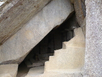
Temple of the Sun at Machu Picchu
The Temple of the Sun here, as Hiram Bingham called it (most of the
names of the buildings came from him, and his guesswork, as he cut back
the jungle from this place in the years following his discovery of it in
1911), is perhaps the most interesting, to me. There are two main
windows in this semi-circular temple. One faces the point on the
horizon where the Winter Solstice, on June 21st, rises, the other the
point where the Summer Solstice, on December 22nd, rises, over a small
temple on the top of an overlooking mountain called, Intipunku – ‘The
Sun Gate’.

The Sun Gate temple - Intipunku, from Machu Picchu

On these Solstice mornings, the first rays of the sun shine into the
temple through these windows and light up the altar stone in its heart.
The masonry – especially of the royal compound and the temples – is
simply awesome. This place seems in many ways, certainly as it has come
down to us molested not by the Spanish, but only by time, bushes, and
trees, perhaps the finest example of Inca High Empire architecture,
hydraulic mastery and urban planning. Almost in the jungle here,
drainage of the buildings and the terraces is of paramount importance,
and provision of fresh spring water for the populace without the need to
climb down the mountain to the river, absolutely essential. The
drainage remains perfect. To this day, a fresh spring from a mountain
on the other side of the river runs through complex buried channels down
to the bottom of the valley, the pressure making it rise again up to
the summit of Machu Picchu where it flows gently, unceasingly, with
unchanging flow and temperature, all year round, still to this day, five
hundred years after it was built.
The place is simply amazing.

The top fountain at Machu Picchu

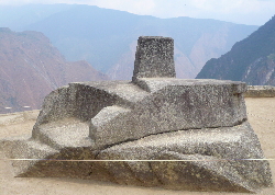
The astronomical observatory at Machu Picchu
At the highest point of the main area of the town is the astronomical
observatory, a carved rock with its corners pointing North, South, East,
and West, and to the four mountain peaks around Machu Picchu, crowned
with a sundial obtrusion that casts its shadows with precision around
the year, allowing precise calculations of Solstices and Equinoxes. It
is famed to have power within it, and all the tourists hold their hands
an inch above it, trying to feel the power. I’m sure if that were
possible it would have been sucked dry long ago by now – there are only
1000 tourists here today: it’s a quiet day.

Llactapata, from the Western tower at Machu Picchu

The Western tower at Machu Picchu facing Llactapata
To the west, in the distance, is Llactapata – another Inca temple that
is aligned to the East and where the Sun can be seen rising over Machu
Picchu at one of the Solstices, precisely over where, here at Machu
Picchu, there is a viewing tower overlooking Llactapata.

Me at Machu Picchu

My guide takes several good pics of me here, and I am grateful. He is
knowlegeable, polite, friendly – as they have all been – and my morning
tour is a great introduction to the place. After another big tourist
buffet lunch at the Sanctuary Lodge, I return alone to take a few more
pics of the Temple of the Sun, and make a last climb to the astronomical
observatory, and then head down on the bus to the delightful El Mapi
hotel, for a shower, and a dry Martini, and a light supper. First thing
in the morning, I am on the 5.30am bus to see the dawn rise over Machu
Picchu. And what an experience this is!

I have ‘seen in the dawn’ on a number of occasions, and got up for the
dawn as often, but this has to be one of the finest of them all.
Climbing to the highest point of Machu Picchu where the ‘watchman’s
house,’ as it is known, looks out over the summit town, one gets an
amazing view of the moment of sunrise, as it crests the tops of the
mountains surrounding the site. Some short distance on its journey from
the the Winter Solstice point, in June, towards the Summer Solstice
point, at Intipunku (Sun Gate), in December, the appearance of the sun’s
orb above the mountain peaks is an awesome sight.
Sunrise at Machu Picchu

The top fountain at Machu Picchu
From the watchman’s house I went down to where the first fountain
produces the flow of spring water that runs in its channels and from
other fountains down through the centre of the royal compound and into
the commons sector. Here, where the royals themselves would have got
their water, I washed the silver, serpentine, smokey quartz and obsidian
jewelry I had bought in Pisak, in the hope that I might take some of
the blessing of Pacha Mama and Pacha Tata back to my home land.

Intipunku

Then the walk up to Intipunku. It’s about an hour each way, said the
guide, but I managed it a little quicker on the way down. On the way up
it was a good 50 minutes, and a hot and sweaty journey with frequent
panting stops. Glad of the strap around my hips, I took it easy, but I
am definitely on the mend, it seems, and the walk was worth the risk!
The reward was absolutely fantastic. Gobsmacking is about the best word
I can think of. From Intipunku the view over Machu Picchu is
incredible. I sat there for over an hour, just drinking in the view. I
met an English girl doing a good bit more of South America, there, and
we agreed on many things. I recommended the Lords of Sipan museum and
Huaca de la Luna to her. It was so peaceful, sitting up at Intipunku –
about five of us at one point, three Dutch half asleep on the terraces,
and us two English types. Absolutely peaceful, at the Gate of the Sun,
with the great orb high in the sky behind us, shining down over one of
the most amazing views I have ever seen in my life, bathing perhaps one
of the greatest pre-Christian temple complexes in the world.

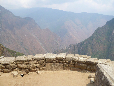
Machu Picchu from Intipunku

And then, from the wall of the terrace at Intipunku where I sat, I stood
up to begin my journey home. It will take me three days – journeying
this afternoon to Cusco, overnight there at the Don Carlos again,
collecting my suitcase, then flying Monday to Lima, overnight there
before finally the intercontinental flight on Tuesday back to Amsterdam.
I will bring home with me some incredible memories. And I will be
back.

Peru Trip #10 – Cuzco to Ollantaytambo

Condors at the Animal Rescue Centre, near Cuzco - click to see more on Flickr
So last night I decided to throw caution to the wind and try out one of the posh restaurants of Cusco – with my credit card. Bistrot was recommended by my Cusco tour guide so I got the hotel to book me a table, and went up for dinner there at 8pm. The food was excellent – clearly a properly trained, imaginative chef. The service was worse than amateur – embarrassing. Once I had got past the language difficulty of wanting a decent bottle from the reasonably good list, rather than just a glass of the local Peruvian Tacama white wine – not bad, but not appropriate for a posh dinner – I had to offer to take over opening the expensive bottle of wine, wincing as the waitress struggled with it, with all the promise of bits of cork ending up in the wine. A nice enough girl, friendly, willing, but with barely any English and barely any training as a waitress. My Jumbo River Prawns were cooked to perfection in a delicious sauce, but again I had quite a struggle (and an empty side plate delivered) before managing to get a small bowl of warm water to wash my fingers. Hopefully they’ll serve one with the prawns to future guests. I realised this was quite a new venture, only open a short time, with much to learn. The best thing about the dining experience, however, was the other two diners in the restaurant, a couple from London in their ‘gap year’ between work and retirement, touring the world. Had a really nice chat with them. Bolivia, they say, is even cheaper than Peru, Argentina about the same, but Brazil as expensive as Europe. Like me, they have found everyone they’ve met to be very friendly, and felt no threat at all, despite all the warnings. We conclude that it must be backpacking poor student travellers in cheap hostels that tend to experience the underside we have been warned of, and that we are cushioned by the reach of our wallets. Having to buy a bottle to get a nice wine with my delicious River and ShellFish ‘Parihuela,’ which came with the lovely Peruvian garlic rice I already enjoyed in the north, I of course was pretty happy by the end of the meal, chatting with the other diners. It was a shame that the service was so poor, and that, in the end, despite the signs, they seemed incapable of making their EFTPOS handheld work, either with MasterCard or VISA, and I had to part with half of my remaining cash for this lovely dinner – money well spent, but which I had wanted to put on the credit card to pay later, not pay for out of the rest of my holiday cash. I made no bones about ensuring they knew my displeasure. My fellow guests were equally put out by this, though perhaps less surprised than I that the signs turned out to be misleading, at best. I still made sure they complimented the chef though !

Me drinking Chicha in an Inca bar

So this morning I awoke somewhat hungover – from wine rather than
altitude, for a change – and was treated as a first stop to an animal
rescue centre, caring for exotic Andean creatures with injuries, or
saved from the black market, and returning them, when ready, to the
wild. I met three condors – huge carrion birds – a couple of pumas, and
some large parrots. On the road away from here, the devastation caused
by the flooding in the last rainy season becomes all too apparent, with
the road washed away in places down to a single carriageway. Six months
ago, this area experienced twice the normal rainfall and, among other
things, the railway up to Macchu Picchu was severely damaged (and
repaired by June, thankfully!) The next stop was a traditional Inca bar,
a homely pub where they make their own ‘chicha’ – a maize corn beer,
served straight to the men and brewed with strawberries and served with a
sprinkling of herbs on top to the women. Very nice, I’d say!

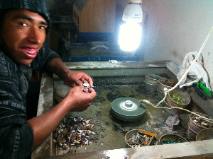
Silversmith grinding semi-precious stones and shells into small pieces and gluing them into silver jewelry with tree resin

Third was Pisak, and its famous market, where I was able to use the
credit card to stock up on Peruvian silver (95% alloy with copper, like
Britannia Silver, better than Sterling Silver which is only 92.5%)
beautifully worked by local craftsmen, with the famous Macchu Picchu
serpentine (flecked with iron-pyrites and haematite), Peruvian smokey
quartz, local obsidian, and a particularly lovely skyblue local
sodalite, worked into the silver casings with local tree resin for glue.
Very lovely. I also parted with some dollars for the rug I have been
looking for ever since I arrived in Peru, and had a sneaking suspicion I
might find here. Natural dyes and hand-woven, I got one with the Inca
calendar in red, black, and blue. Very nice. I feel like a good
tourist now, with my souvenirs and gifts for friends back home.

Ollantaytambo - click to see more on Flickr


So the main event of the morning, and I am thankfully quite awake by now
(parting with money often has that effect). Ollantaytambo sits at the
junction of three valleys, including the Cusco valley, and the Sacred
Valley where Macchu Picchu lies. The winds combine here and the Incas,
great technicians that they were, built their storage houses just where
the winds meet and keep the temperature a good 3-4deg lower than on the
valley floor. Either side of the river in the middle of the valley they
built houses for the common people on one side, and the royal compound
on the other. A tambo is literally that – a staging post for the royal
household on its journeys around the empire.

The Terraces at Ollantaytambo - click to see more on Flickr


The terraces here are extremely cleverly formed, with different clays
and soils and at different altitudes to create a series of
micro-climates perfect for potatoes, beans, fruits, and coca leaves –
yes jungle coca leaves growing in the corner of the Sacred Valley,
rather than imported like pretty much everywhere else.
The Profile in the Mountain overlooking Ollantaytambo - click to see more on Flickr
The mountain with the cold storage houses also sports a carved human
profile near its peak, as viewed from the Temple of the Sun at the top
of the terraces behind the royal compound. On the winter solstice on
June 21st the sun rises over distant mountains right at the third eye of
this profile, and shines directly across the valley hitting the Temple
of the Sun first before anywhere else. Coming from sources unknown,
pure mountain spring water at constant temperature and flow appears from
spouts into channels to snake around the terraces as irrigation, and –
most beautifully of all – to create a series of pleasure garden channels
through the royal compound. One wonders if they maybe even had
fountains, after the moorish fashion of contemporary buildings across
the Atlantic like the Alhambra. The whole place is like a holiday
resort in that sense, with the old Inca town square with its flowing
water channel today’s tourist market at the entrance to the
archaeological site: the royal compound, terraces, and what remains of
the Temples the Spanish left behind, when they broke them down to use
the stone to build their churches. The common people’s side of town is
still lived in, Inca streets running up the hills from the main street
into town.

Water feature with tap at Ollantaytambo - click to see more on Flickr


Last stop is at Tunupa, a fantastic buffet restaurant for tourist buses,
with excellent food, and a delightful riverside garden, where I eat
heartily before being dropped at my hotel prior to tomorrow’s early
morning trip to Macchu Picchu.

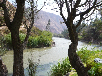
The river at the bottom of the gardens at Tunupa Restaurant - click to see more on Flickr

Peru Trip #9 – Saqsaywaman, Cuzco

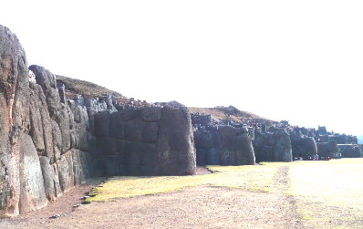
Me and one of the megaliths at Saqsaywaman, Cuzco - click to see more on Flickr
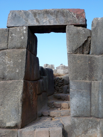
Well, the Incas were truly extraordinary masons. For all that this was – in European chronology – a medieval culture, in the 15th and 16th centuries CE, it was a megalithic culture. Not the megalithic culture of thousands of years BCE, on the Atlantic fringe of Europe and the Mediterranean, but a megalithic culture that had mastered building with stone in an extraordinary way. There are mortice and tendon joints, and metallic rings sunk into carved grooves between stones, inside these huge walls, and carefully graded horizontals that incorporate subtle ratchets at strategic points. The basic shape is trapezoidal: walls and doorways and niches that stand with legs apart. All this makes Inca buildings effectively earthquake proof – both supremely stable and protected from horizontal movement.
Example of masonry techniques at Qoricancha, Cuzco - click to see more on Flickr

Churches built by the Spanish on top of Inca temples (Christianity,
after all, built on top of pagan sites the world over, to cancel out the
old gods with their new religion) fell in the earthquakes of 1650 and
1950 and 1986. The Inca temples are only ruined by deliberate Spanish
destruction, and by having been treated as quarries right up until legal
protection in 1936. Cusco city is an image of the Puma, with the
Temple of the Sun at its phallus, and the complex of Saqsaywaman at its
head (the name Saqsaywaman literally means, Puma’s head).
Our guide shows us the Puma on the map and satellite photo - his finger on the phallus, Saqsaywayan the head
A drawing of the Cuzco puma

The layout of the Saqsaywaman site

The zigzag walls of Saqsaywaman main temple site

The zigzag construction is the hair on the lower jaw of the Puma, the
three tiers the three levels of the cosmos – underworld (snake), earth
(puma), and sky (condor). All that is left now is the foundations – you
can see the drainage holes that kept the place dry during the rainy
season. There were three towers on top of Saqsaywaman – one 160km
square, and one circular with three concentric rings of stone, that was
an enormous water tank. The hydraulic mastery of these genius
stonemasons, furthermore, continues to work perfectly where these
temples still stand, serving water at constant temperature and flow
regardless of season, from sources modern archaeologists have simply not
found.

The ritual cleansing site

There is ample evidence of how they were able to take water from high
places, channel it through carefully carved stones down into valleys and
back up to high places on the other side of valleys, using the pressure
created by shrinking the bore of the grooves they forced the water
through. These technologies, moreover, were sacred – stone and water,
and the knowledge of their manipulation, were pure. There is no mortar
holding any of these stones together. The water flows through holes
bored through stone, along channels paved with stone tiles, never
through clay pipes. Sand, clay and ramps were used, but only to
transport the stone: the quarry for the main temples at Cuzco is 17km
away, and it is estimated that it took 20,000 people working every day
77 years to build just the one large temple as Saqsaywaman on the hill
overlooking the city. They did not have the wheel. Yep, that’s right,
they did all this without using wheels. The Incas were truly
extraordinary masons.

A doorway from one level to the next of the zigzag surround of the main temple site at Saqsaywaman

Peru Trip #8 – The Inka Express from Puno to Cuzco, stopping at

Statue of a Pukara Priest c400BCE - click to see more on FlickrThe Inka Express is an extremely long bus ride – usually a 6hr drive – which takes over 9hrs, due to all the stops along the way. But time goes quickly, and it doesn’t seem to drag, as a journey, at all. Leaving Puno, barely having slept, with an altitude headache only partly dulled by 10minutes attached to the oxygen bottle before getting up, jacked up on matte de coca (coca-leaf tea) I half expected the journey to be awful. But I managed to dose during the first part of the journey, awaking to be delighted by the Pukara museum, sporting a whole collection of statuary from the ‘mother culture’ of southern Peru, who lived here around 400BCE. The catfish and the frog turned out to be particularly important animals for these people, but the puma and the snake made early appearances – they both figure heavily in later cultures – and the quality of the carving is really quite special.

Statue of a Pukara Priest c400BCE - click to see more on Flickr

Returning to the bus, I am exhausted just by this short tour around the
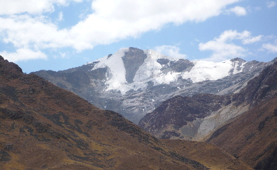
museum. Our next stop, at 4335m (14,200ft) above sea level, is at Abra
La Raya where the two mountain ranges the girt the Altiplano, where Lake
Titicaca rests, meet and join, and the Sacred Valley down to Cusco
begins. There are snow-capped peaks here, although my Puno guide says
they were much whiter in his youth. The smoke clouds from the 25 fires
burning in Bolivia adds a haze to the sky. The Vilcanota River that
beings in this valley eventually joins the Amazon, and flows out to the
Atlantic Ocean. By this point, my head is hurting, the ibuprofen I
took at breakfast has worn off, and I am just glad that the descent has
at last begun. Over the next 40mins we descend more than 1000m to our
buffet lunch, and the Sacred Valley proper.

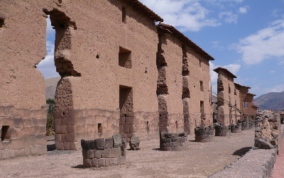
Here we find our first proper Inca archaeological complex – Raqchi,
which means ‘ceramic.’ Unusually for Inca architecture, the main temple
is built half in stone, their preferred building material, and half in
adobe – the mud brick of older cultures. The entire complex, moreover,
is completely surrounded by a huge wall. The thinking is that the
Tihuanaco people who were being supplanted by the Inca here were
rebellious, and the complex had to be built quickly, and defended. In
the Temple to Wiracocha, the most important Inca god, there are, also
unusual for Inca buildings, circular columns, which used to hold up the
roof.

Temple to Wiracocha, Raqchir

By the time we reach Cusco the air is just so much nearer what sea-level
dwelling folks like me are used to, and although a bit thin, (it is
still 11000ft, after all) I can think, I can move around, I have no
headache, and the constant fatigue of the last few days in Puno is
finally wearing off. It’s like getting well again after a massive
hangover. Speaking of which… a glass of wine might now be in order!