Introduction

Todger. Willy. Knob. Yep – this is a blogpost about the penis. Not my penis. Not yours or anyone else’s – not any particular penis, in fact, but The Penis. Not even just The Penis, either, but The Erect Penis: aka The Phallus.
Let me put this into some context. What follows is a fairly lengthy introductory ‘context’ preamble, and then a discussion about the Phallus. But before we start I need just to say that this is NOT, of course, a post about femininity, or from a particularly feminist perspective, albeit written by a feminist. But I want to mention right away how pleased I am that, at last, there has been, over the past hundred years or so, some movement on gender equality, although there is still a long way to go. So, that said, back to The Phallus.
1 – What do I mean by ‘Ancient’
‘Ancient’ – when we’re talking about Classical Times, this means Ancient Greece and Rome. ‘Ancient’ also, however, also often means pre-Historic. History – (in practice if not in etymology: ‘his story’)- is by definition written, and therefore since the advent of writing, it has been patriarchal, i.e. stories about men running things and ‘his’ being in charge.
This post about the Phallus in Ancient Greece needs to start with an acknowledgement that there remains some debate about how old patriarchy is, when and how it arose, whether it was preceded (in Europe, or anywhere else) by matriarchy or matri- or gynocentric cultures that have not been recorded as a part of our ‘history’. Margaret Murray and Marija Gimbutas are perhaps most responsible for some of these ideas, and despite many academic misgivings concerning their methods, there seems also to have been widespread acceptance that there is some truth in what they asserted. As Ronald Hutton explained, of course, such acceptance did not mean they were right, and the mythology of a pre-Patriarchy matricentric ancient culture centred around a single Mother Goddess may indeed be just that: a mythology.
It must also be recognised that ‘History’ arrived in various parts of the world at different times. In some Amazonian corners it is still making its first appearances, thousands of years since developed writing first arose in the Middle East in the 4th millennium BCE. (Such developed writing systems grew slowly from a wide range of different Neolithic symbol and number systems, evident as early as the 7th millennium BCE both in China, and, according to Gimbutas, in Serbia, in the mysterious and untranslated Vinca symbols.)
So ‘Ancient Greece’ is something that could be understood to be both pre-historic, and historic, under conditions both of gynocentric and patriarchal social structures.
2 – Is this just a ‘gay’ thing?

Sexuality, per se, inevitably, figures hugely in any discussion of The Phallus. As a gay man myself there will inevitably be a lot about same-sex activity in this post. But The Phallus is obviously a Male thing, and it goes beyond sexuality, into spirituality. I need to say a thing or two about the roots of our modern notions of sexuality.
Anyone who has even heard of Foucault’s four volume History of Sexuality will know where I’m going with this. For the last two thousand years we have – as a species – been subject to, at first the Christian, and then the Islamic, suppression of non-procreative sex. Whether this is an innate part of how patriarchy works, or a later addition for the purposes of greater control of the self, there remains much debate. Without doubt, however, since the early 4th century CE edicts at the Byzantine Council of Nicaea against male same-sex activity, (perhaps simply aimed at arresting some Greek Philosophers who dissented from the new Church doctrine), Christianity has sought to repress our sexual natures, and confine our activities to strictly procreative acts. It was Peter Damian, in the 11th century, striving to stamp out the male same-sex activity that was rife amongst the clergy and in the monasteries, who first limited the notion of ‘sodomy’ to acts undertaken with a penis. Until then the story of Sodom, where Lot offered his daughters to be ravished by a mob, seemed focused less on male same-sex activity than on anything that was not strictly procreative.
Islam, from the 7th-8th centuries onwards, followed suit, in much the same vein. Despite edicts from the pulpit and minaret, however, there remained much ‘leeway’ and tolerance for centuries, and it was only in relatively recent times that attitudes really hardened. With the industrial and scientific revolutions in full swing, the British Empire, in Victorian times, helped to spread European ideas that medicalised sexual activity and ‘invented’ whole categories of ‘sexuality’ – ascribing a name to a series of specific sexual acts and ascribing that set of acts to particular types of personality: The term ‘homosexual’ was first coined by Hungarian sexologist Kertbeny (1869). This notion was taken up by Westphal in a famous article in 1870 as, “contrary sexual sensations” – regarded by Foucault as the “date of birth” of the categorisation, ‘homosexual’ (Foucault 1990). An 1895 translation of Richard von Kraft-Ebing’s sexologists’ bible Psychopathia Sexualis (1886) saw the word’s first appearance in English (Halperin 1990). Such Victorian values of prudery gradually changed the British Christian laws against sodomy (first introduced by Henry VIII in 1533, and a capital offence until 1861) into laws against a type of person – the homosexual. As early as 1860 in India, laws against sodomy were simultaneously exported to the colonies. So in the 21st century we see “sodomy laws throughout Asia and sub-Saharan Africa have consistently been colonial impositions,” (Gupta 2008:10) and do not reflect pre-colonial cultural mores. Such laws are, as Gupta titles his treatise, an ‘Alien Legacy’. “No ‘native’ ever participated in their making. Colonizers saw indigenous cultures as sexually corrupt. A bent toward homosexuality supposedly formed part of their corruption. Where pre-colonial peoples had been permissive, sodomy laws would cure them—and defend their new, white masters against moral contagion.” (Gupta 2008:10).
In ‘ancient’ times, then, the notion of ‘sexuality’, as we understand it today, simply did not pertain. People had sexual relations with each other, plain and simple, and such relations did not define who one was, in any sense. It is therefore likely that many, if not most people, were what we might today consider ‘bisexual’. Indeed, Ryan and Jetha assert in their book, Sex at Dawn, that their interpretation of the anthropological data suggests that even monogamy is a latter-day social creation.
So no, it is not a ‘gay’ thing, because ‘gay’ (a 1950s redefinition of an older word) and ‘homosexual’ (a late 19th century Victorian invention) simply did not exist in ancient times: the Phallus was a part of all male sexual activity.
3 – OK so what about today?

Modern attitudes to sexuality have – as we all know – very swiftly changed, in the last decade or two, and this is greatly to be welcomed. Legalisation of homosexuality in the West, during the 1960s and 1970s, has been followed by equality in age of consent, legal protections, employment laws, and most recently marriage law. Young people today are increasingly ‘heteroflexible’, sexually fluid, (or even pansexual) in their attitudes: yes, these young people are still mostly straight, but increasing numbers would happily go with the right person for a same-sex experience, and not consider it a problem. Perhaps this is closer to what Ryan and Jetha were on about, or a transition towards it at any rate. Sad to say, there has been a great polarisation, however, and whilst attitudes in the ‘West’ and ‘North’ have changed such that things have never been so good, in the ‘East’ and ‘South’ things have got much worse. At the United Nations, in March 2011, 85 of the United Nations’ 192 member countries sponsored a new version of the declaration first proposed in 2008, recognizing LGBTQI rights (Jordans 2011), and followed it up with a report published in December 2011 documenting violations of the rights of LGBTQI people around the world, including hate crime, criminalization of homosexuality, and discrimination. With the notable exceptions of Israel, Turkey, Jordan, Iraq and the West Bank (in the Palestinian Occupied Territories,) same-sex activity is illegal throughout the Middle East and North Africa. In most countries in this region there is no recognition of same-sex relationships or same-sex marriage; there is no legal route to same-sex adoption; gays are not allowed to serve openly in military; there are no anti-discrimination laws covering sexual orientation, or laws concerning gender identity/expression. In the Sudan, Somalia, Iran, Saudi Arabia, and Yemen, homosexuality is punishable by the death penalty (Bruce-Jones & Itaborahy 2011). LGBTQI people are to all intents and purposes invisible in public spaces in these countries. It can only be hoped that this turn for the worse is soon reversed, and that attitudes soften once more.
In the West, though, now, we are welcoming in the extraordinarily liberating times of gender fluidity: transgender rights are in the newspapers, being championed (with varying success) by celebrities – think Eddie Izzard, Eddie Redmayne – the list is long…. More profound, still, in the spaces where gays and lesbians carved out their rights in the late 1990s and early 2000s, that have, in recent years, become somewhat colonised by Hen nights, a new thrust of drag and transgenderism is retaking the ‘scene’ with a spirited gusto that can only be praised and supported.
The Phallus
SO, as the (very lengthy) preamble finally moves towards its conclusion, my question is: is it time to recall, also, the sacred phallus of ancient times – the erection that represents virility, life-force, ‘generative power’, spirit : not in a patriarchal way – nor in a ‘gay’ way – but unashamedly ‘cocky’ nonetheless. It would, I believe, be in keeping with the new flexibility in sexuality and gender, to begin again to be more open about The Phallus.

Collections of material related to this topic – often known, in 19th century terms, as ‘erotica’ – used to be private, the whole thing frowned upon; now in more enlightened times this study is coming to light, less the focus of reproach or giggles, more of serious anthropological interest. Let us – for example – recall the story of The Warren Cup (see the excellent British Museum booklet on it). In solid silver, it has exquisite depictions of man-on-man anal sex on it. It was refused when first offered to, but later expressly bought by the British Museum, in (these) more enlightened times. The Museum have since also celebrated Hadrian and Antinous – the Roman Emperor famous for his northern British wall, and his younger male lover. More importantly, those sculptures with Phalloi which survived the destruction wrought by Victorian explorers who broke them off statues as a matter of public decency, are now being brought out of private collections and displayed in our museums.
I think the time is indeed ripe for people to consider and appreciate the beauty, spiritual history, cultural significance, and potency of The Phallus, and to understand it anew – and in a modern context.
Background
Having ‘contextualised’ the broader debate, we need also to spell out a bit of the ‘background’ of discussion around The Phallus. It must be recalled – though it is perhaps impossible for any modern eye to see through the eyes of the pre-moderns, that, as far as we can understand it, pre-modern sexuality – the ancient form of gender flexibility – had none of the Victorian embarrassment or prudery around sex, sexuality and nudity of modern times. Sex was much more openly a part of our lives, much more vibrant and present, absent the shame and discounting that is habitual in this day and age: it was front and centre: I would say, as it should be. This was true not just for family life, but for those engaging in same-sex relations too.
Although in Europe the purging of the ‘pagan’ religions by the Inquisition was so complete that there remain scant – if any – remnants of how things were before the imposition of the notion of ‘Sin’, elsewhere in the world it is clear that such prudery is far from typical of the human condition.
As Stephen Murray asserts, Islam replaced pagan religions across the Middle Eastern region that included “sacred sexually receptive – often gender-variant – functionaries” (Murray & Roscoe 1997:24) – and Roscoe argues that the ‘eunuchs’ who ran the vast bureaucracies and harems of the Empires of the ancient Middle East may not even have been castrated: the translation of their title as ‘eunuch’ is laden with the historical overlay of 19th century English commentary. It is closer to the truth that these functionaries were simply not a dynastic threat to their rulers – uninterested in procreation – and in any case where castration was in evidence it is clear that it was also reserved in many cases only for the very highest ranks of such functionaries. Societies in the Middle East, then, included families and single men and women. The latter were more normally gathered in segregated groupings, either in temples or colleges. But not always. Nor were the male heads of the families always exclusive to their wives, or to what we would today call ‘heterosexual’ behavior outside of their marriages. According to Herodotus, even wives would spend time in the Temple of Aphrodite at least once in their lives, to be visited by a Temple devotee, to whom they would grant their favours.

Roscoe tells us more, too, about same-sex behavior in ancient times. “The category of status-differentiated homosexuality, includes not only paederastia, relations between adult men and youths such as flourished at Athens, but all relations between individuals socially defined as male in which one partner is of higher status than the other.” Status-differentiated homosexuality, then – familiar in English public schools like Eton between sixth formers and their younger ‘fags’ (Bullough and Bullough 1979) – is universally based on “a distinction between the inserting (high status) role and the penetrated (low status) role in sexual intercourse.” The more institutionalised, status-differentiated homosexualities appear “to have been more limited to the Mediterranean basin and areas of southwest Asia influenced by Greek and Roman culture” (Murray & Roscoe 1997:56). Third-gender roles, meanwhile, it seems, were common throughout the region, including, “state third-gender roles, in which gender difference was linked to specific positions in state and civic institutions, and folk third-gender roles, exemplified by the devotees of popular goddess cults,” such as Cybele, common to all the ancient cultures in all the regions that Muslims eventually contacted (Murray & Roscoe 1997:56), and indeed throughout the Roman Empire, including many altars to Cybele in Britain. That these third-gender roles so prevalent in the pre-Islamic Middle East and North Africa, and absorbed into pre-Modern Islamic culture, continued not only into the 19th century but – in some places – to the present day, is evidenced by the discovery, during the war in Afghanistan, by American troops, of institutionalised pederasty in the Pashtun areas of the Af-Pak border region (Wijngaarden & Rani 2011).
![Priapus. [Vindolanda, England]](http://kreps.org/blog/wp-content/uploads/13972790240_9d8a2a8551_o.jpg)
The spirituality of sex, then, with ‘hierodules’ – religious functionaries (and devotees performing once-in-a-lifetime service) whose function was to have sexual relations with temple visitors – both male and female, and for both male and female, according to mood, the deity, or need, is something quite widespread, and ancient. So, we can move (at last!) to direct consideration of the pillar at the centre of this post.
The Sacred Phallus

First-off, it is a global phenomenon. By this I mean that it is likely something as old as humanity itself, to see in the image of the erect penis a symbol of much that is important to us. Until the advent of modern science – spermatozoa were not discovered until the late 17th century – it is likely, even, that little was understood concerning ovulation, and indeed Greek writers such as Aeschylus and Galen suggested that human beings emerged from the ‘seed’ within semen, and that the womb was merely the place where it grew before emerging as a baby. That such anatomical ignorance helped to impart some of the significance that semen, and the Phallus, had for people, should not, now, in more enlightened times, lead us to dismiss that significance altogether. The seed remains the bearer of half the genetic material, and the spark that sets things going in the egg that it finds. There are some assertions that the drinking of semen in religious rites is very ancient, and was even still being practiced in early Christian mystery sects. The importance of the Phallus, therefore, for ancient peoples – even during gynocentric times – cannot be overstated.

Neolithic peoples, aside from the many goddess figurines many of us will be more familiar with, also left behind many phalli in the archaeological record – the world over.

As the (less than academic) books of Alain Danielou And the highly academic work of Asko Parpola both assert, the ancient Indian deity Shiva, whose story Danielou traces back to the Indus Valley civilisation (3300BCE) – whose Phallus forms the central pillar of the world and whose semen spawned the universe – can be considered a cultural ‘original’ for a host of later, regional variations, gradually moving westward through the Middle East, as the Lord of the Animals, into Europe, where his story and role in local pantheons is found under the name of Dionysus (and of course his son, Priapus), Bacchus, and Cernunnos.

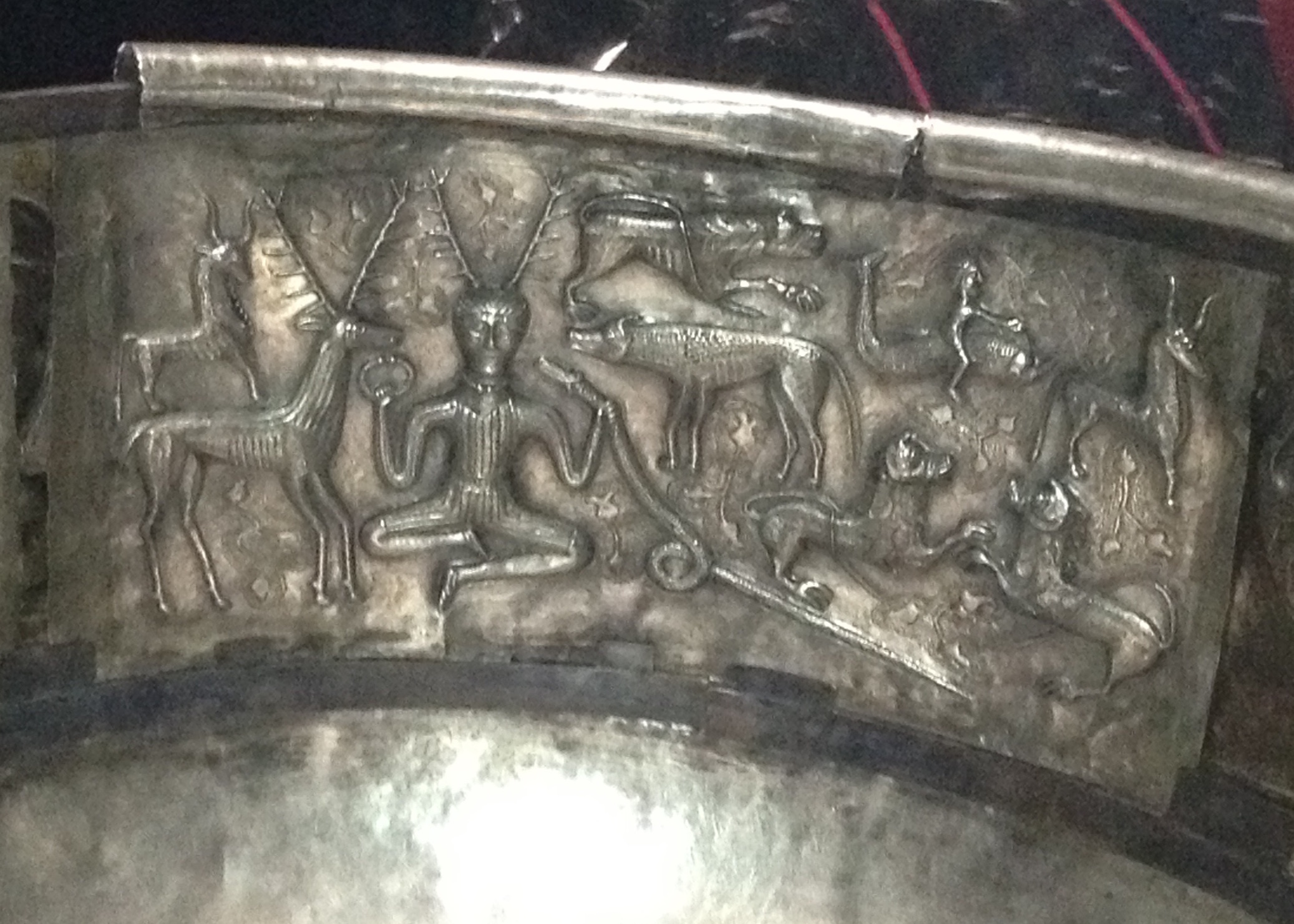
These ‘horned’ or ‘horny’ deities, whose Phalli represent Creativity, Life, Power and Inspiration, have so much in common, according to Danielou, that their local and regional variations are almost merely accents, rather than dialects, of an original Shivaic tongue. Certainly the main image we know of Cernunnos – from the Gundestrup cauldron – set beside the Indus Valley civilization depiction of (proto-) Shiva, seem to suggest that they contain many identifiably common themes.


Danielou asserts that (Greek) Dionysus and (Roman) Bacchus are closely linked to the (Indian) Shiva story. Such linkages are a common theme going back many centuries. Herodotus and Diodorus Siculus both believed the Greek Gods derived ultimately from the Egyptian pantheon. There are interesting arguments that it was in fact the phallic rituals that they all have in common that form the principal link.
Indeed the focus in this post is not to suggest such correlations, many of which may have simply been the result of syncretism in ancient times, but upon this common theme of the Sacred Phallus, and its prevalence across the ancient world. Beyond the more obvious Greek and Roman fascination with the Phallus, there is of course Egypt’s Pamyles, the Priapic God whose (Spring Equinox? see comments below) festival, the Pamylia – the ancient Egyptian phallophoria – were a celebration of his fostering of the child Osiris, one of the five all-important intercalated days between each 360day year (see Plutarch’s account, and the mention in Theodor Kock’s Comicorum Atticorum Fragmenta (vol2) p289). Small Horus child statuettes with hugely exaggerated phalluses are found in their thousands along the sacred waterways where this festival (among others) took place, deposited in the waters as votive offerings to the fertility of the Nile inundation. Better known still, perhaps, is Egypt’s God Min, whose ithyphallic likeness appears frequently on the walls and pillars of the temples at Luxor, and who presided over the coronation ceremonies of New Kingdom Pharoahs who may have been expected to ejaculate as part of the ceremony – thus ensuring the annual flooding of the Nile.

Aside, too, from the Gundestrup cauldron, there is also the assertions of J.G. Frazer concerning the use the Druids of Old Europe had for Mistletoe: for them the white berries represented the semen of the Gods – according to Frazer, anyway – suggesting a common thread with sacred phallic practice elsewhere. There is the extraordinary work in Papua New Guinea of Gilbert Herdt on the Sambia male initiations – where boys drink the semen of the older boys and men of the tribe as part of their education: the semen is what makes them into men. In North America, there were the Native American berdache or Two-Spirit people, and, according to James Neill, cave-paintings of palaeolithic shamans with erect penises, dancing among the game animals. In South America, the Moche in particular represented the Phallus in their ceramics.


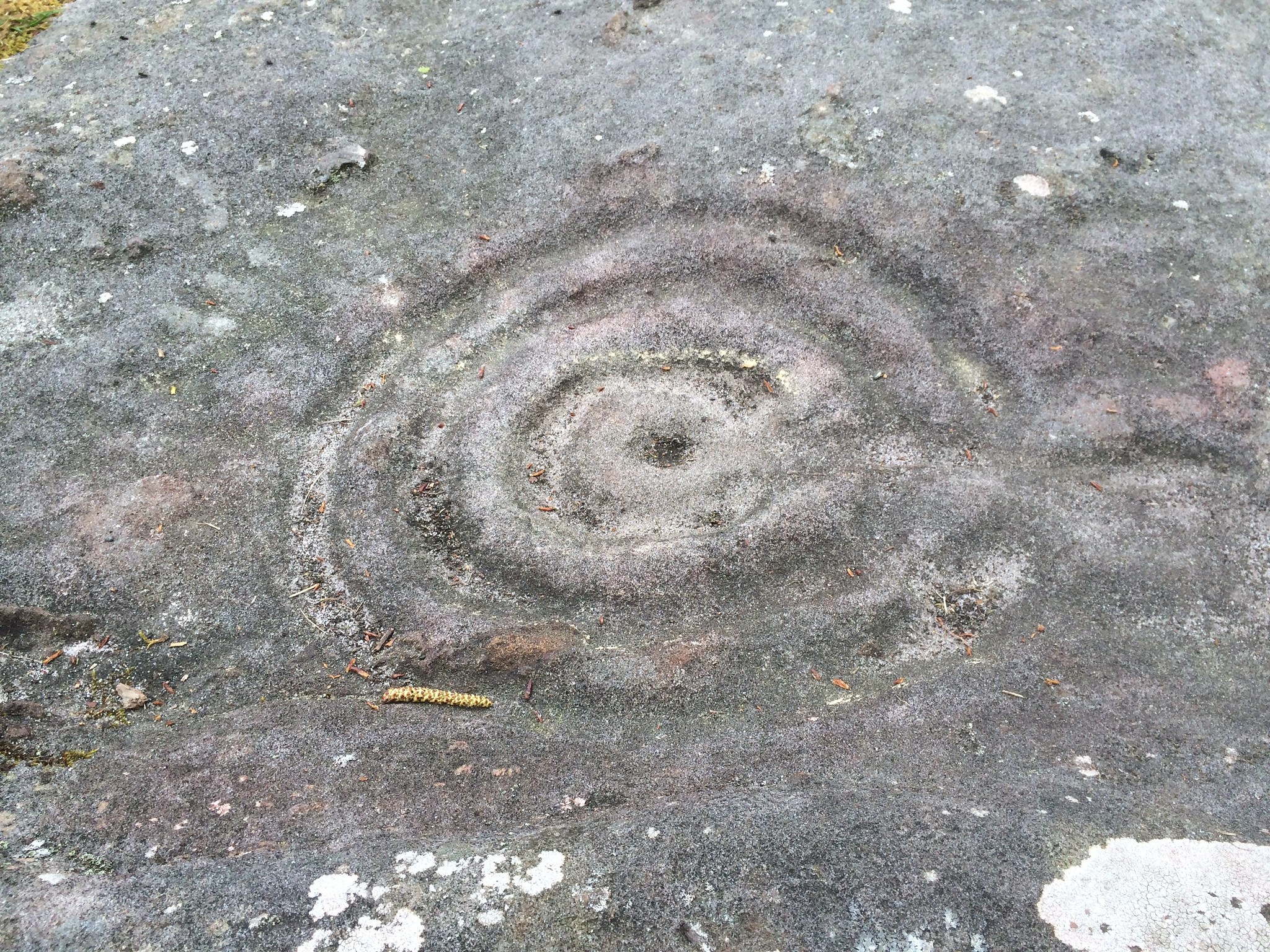
And at Chucuito in Peru there is this enigmatic Aymara/Inca temple:

So to find the Sacred Phallus in Ancient Greece is indeed not at all surprising. There are both antecedents that can be cited as origins for its presence, and plenty of evidence that the Sacred Phallus has been the focus of cultural and spiritual attention in all parts of the world.
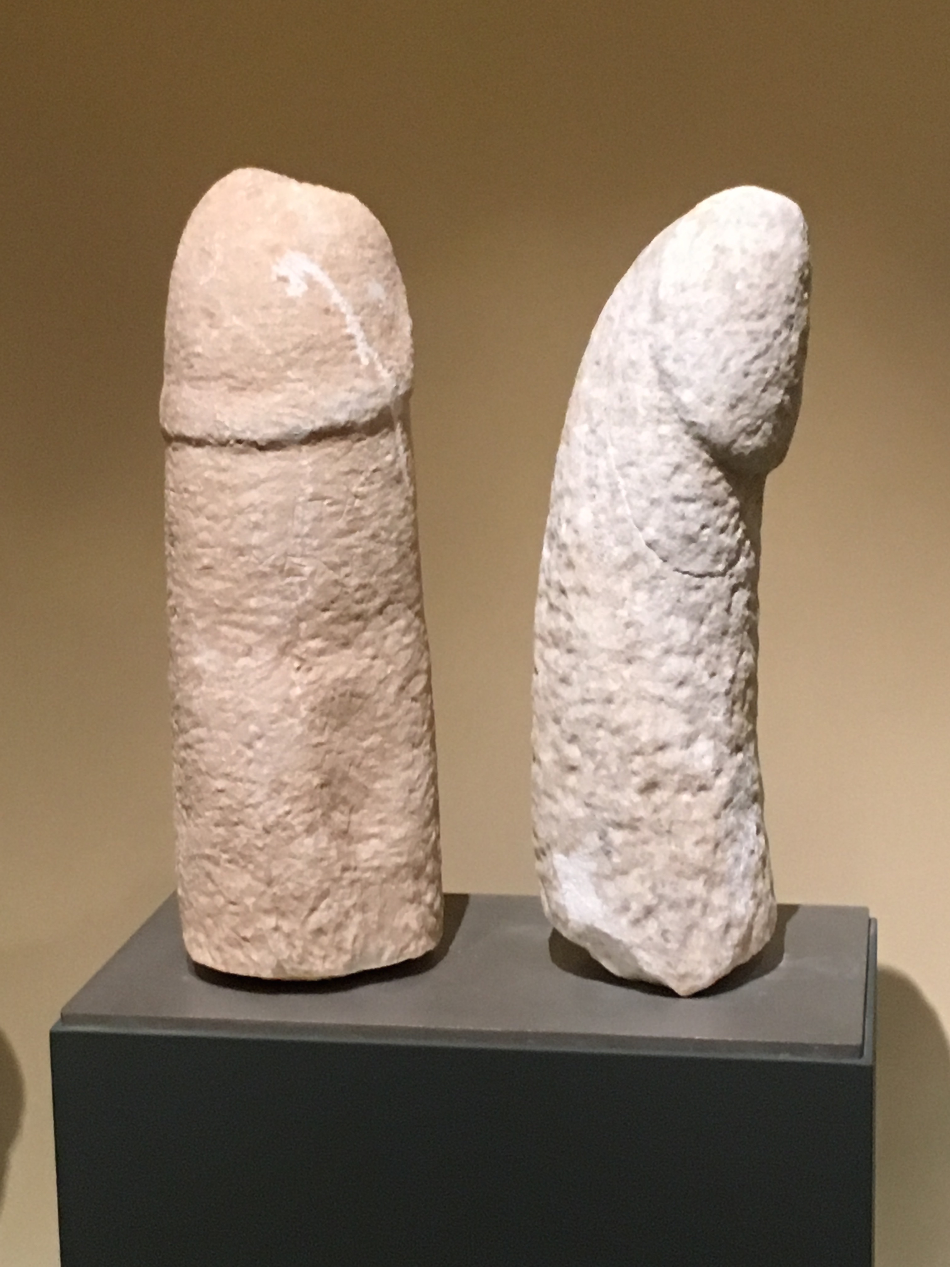
The Phallus in Ancient Greece

The Phallus in Greece is evident from the 7th millennium BC at least.
In the Classical period, once the Bronze Age was well under way, still the stone statuary honoured the Phallus – as testified by one of the most famous statues on Delos, for example:

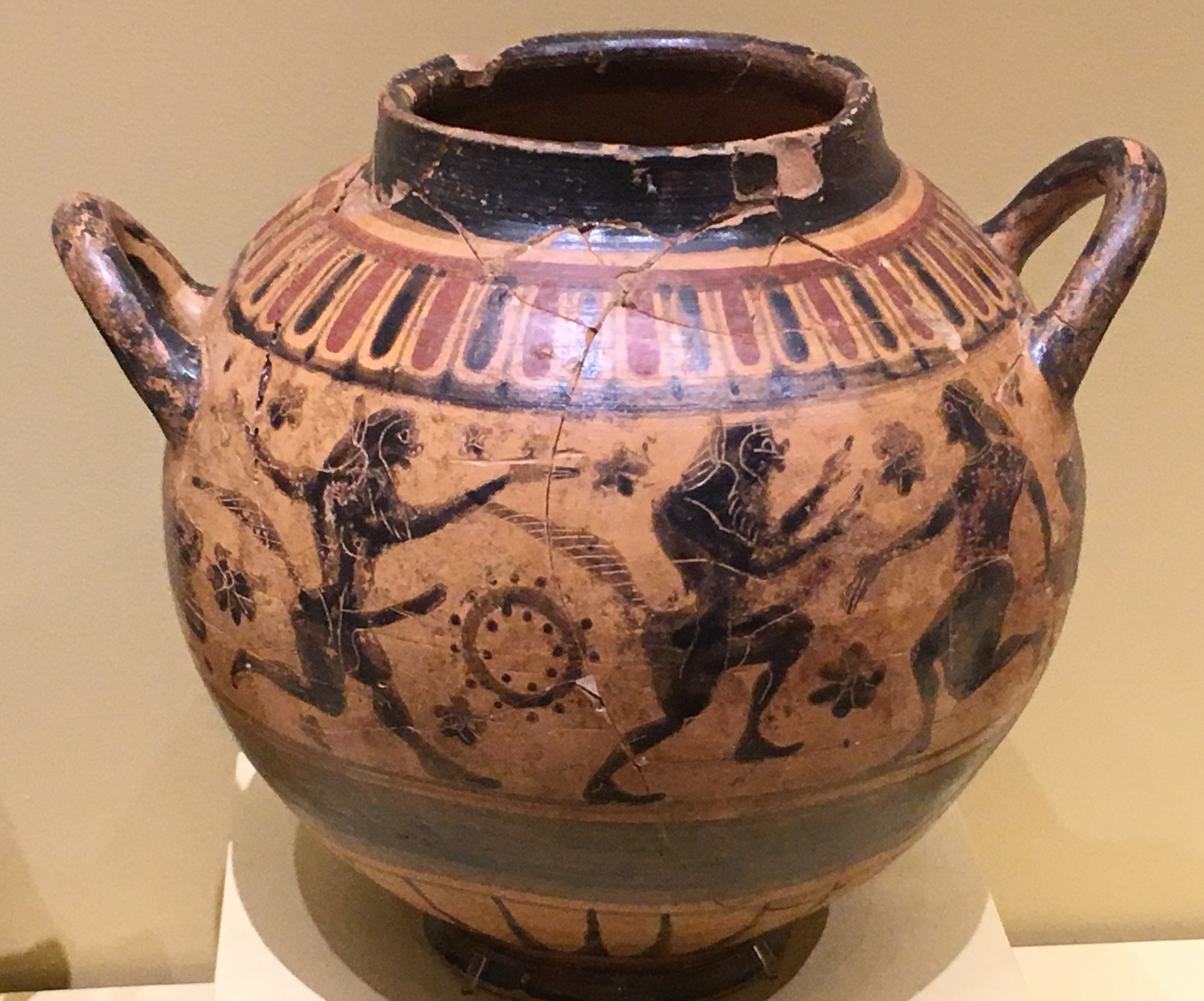
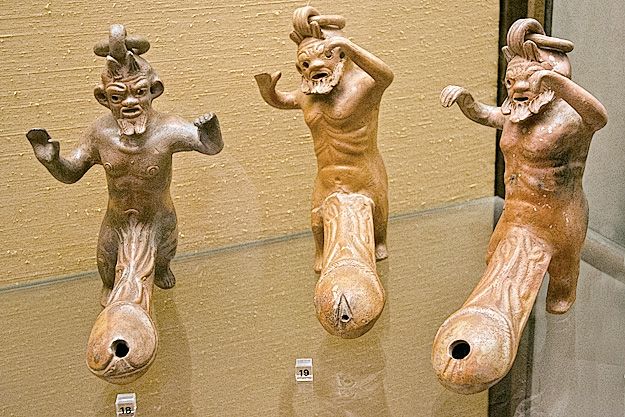
The Satyrs of the period are renowned, of course, for their ithyphallic representation, along with the Sileni and Priapus, and of course Pan:


Hermes was one of the Greek Pantheon – a son of Zeus – who was thought of as the one who leads souls to the other world and can restore them to Earth, feeding them with the power they need. He was the God of boundaries and their transgression, the protector of tombs, the “patron of magicians”. At road junctions and at street corners one would often find a ‘Herm’ – an ithyphallic statue of the God, Phallus proudly erect – to mark the transition from place to place.
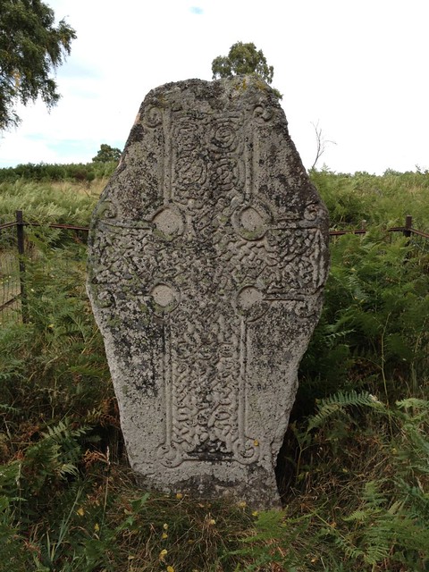
In Thessaly, his cult had particular importance, uniquely so in Greece: on grave markers a Herm is represented accompanied with an invocation to Hermes Chthonios. In this manner, the deceased is identified with the God and coexists with him in the actual monument. The grave marker was sometimes simply a large stone Phallus.
According to Danielou, it was in honor of Dionysus that Greek villages organized Phallophoria festivals in spring: phalloi were carried in ritual procession. Kerenyi tells us that the revealing of a phallus in a basket figured as a central element of mystery cult initiation.
Nor was the sacred phallus in spiritual contexts the only manifestation of 6th and 5th century B.C. penis art. On one Greek island at least – Astypalaia – archaeologists have found “some of the world’s earliest erotic graffiti.”

Today
Is it all gone? Suppressed by modern patriarchal religions? No. Here and there, there are strange relics, hangovers, echoes. The Sambia people are probably still around, though Herdt disguised their name and location, and there is debate around their practices, and whether they constitute abuse.
Less controversially, there’s a Penis Cafe in Sicily, a Phallus Museum in Iceland, a Penis Park in South Korea, and two annual Phallus Festivals in Japan. Also, though frowned upon by the Orthodox Church, even in Greece, there are echoes of this ancient past… In Tyrnavos, a small village near the capital of Thessaly, Larissa, an echo of this ancient practice lives on – perhaps even related to the more Roman Liberalia, at this time of year. There is no evidence that the Tyrnavos festival is older than the late 19th century. But its heritage is clear, and the Phallophoria takes place on the Christian festival of ‘Clean Monday’ every Spring.
In the next blog post, I will describe my experience, as I arrive and wander around the Phallophoria of Tyrnavos, 14th March 2016.
NOTE: This post developed into the later chapter by myself and co-author Caroline Ruddell:
- Kreps, D. and Ruddell, C., (2022) The Phallus: Power and Vulnerability. In: Meredith Jones and Evelyn Callahan, Performing the Penis: Phalluses in 21st Century Cultures London: Routledge doi:10.4324/9781003108481-2
Bibliography
Bruce-Jones, E & Itaborahy, L (2011) State sponsored homophobia 2011 http://old.ilga.org/Statehomophobia/ILGA_State_Sponsored_Homophobia_2011.pdf
Bullough, V. and Bullough, B. (1979) Homosexuality In Nineteenth Century English Public Schools International Review of Modern Sociology 9(2) pp. 261-269 http://www.jstor.org/stable/41420705
Conner, R. P., Sparks, H. D., and Sparks, M. (1997) Cassells Encyclopedia of Queer Myth, Symbol and Spirit. London: Cassell.
Danielou, Alain. (1995) The Phallus: Sacred Symbol of Male Creative Power. Trans. by Jon Graham. Inner Traditions International, Rochester, Vermont.
Danielou, A. (1992) Gods of Love and Ecstasy: The Traditions of Shiva and Dionysus Rochester, Vermont: Inner Traditions.
Foucault, M. (1990a). History of Sexuality Vol 1: The Will To Knowledge, Penguin, London
Foucault, M. (1992). History of Sexuality Vol 2: The Use of Pleasure, Penguin, London
Foucault, M. (1990b). History of Sexuality Vol 3: The Care of the Self, Penguin, London
Frazer, J. G. (1996). The golden bough : a study in magic and religion. London, Penguin.
Gupta, A (2008) This Alien Legacy – The Origins of “Sodomy” Laws in British Colonialism, New York: Human Rights Watch http://www.hrw.org/en/reports/2008/12/17/alien-legacy-0
Halperin, D (1990) One Hundred Years of Homosexuality London: Routledge.
Herdt, G. (1981) Guardians of the Flutes: Idioms of Masculinity. McGraw-Hill.
Jordans, F (2011) ‘UN Gay Rights Protection’ http://www.huffingtonpost.com/2011/06/17/un-gay-rights-protection-resolution-passes-_n_879032.html
Kerenyi, Carl. (1976) Dionysos: Archetypal Image of Indestructible Life. Princeton University Press, Princeton.
Kertbeny, Karl-Maria (1869) Paragraph 143 of the Prussian Penal Code and Its Maintenance as Paragraph 152 of the Draft of a Penal Code for the North German Confederation. Leipzig: Serbe’s Verlag http://www.boxturtlebulletin.com/2008/05/06/1942 (Viewed 9-2-2012)
Murray, S & Roscoe, W (1997) Islamic Homosexualities: Culture, History and Literature New York: New York University Press
Neill, J. (2009) The Origins and Role of Same-Sex Relations in Human Societies, Jefferson Caroina: McFarland
Ryan, C., & Jetha, C. (2010) Sex at Dawn HarperTorch
Sergent, B (1984) Homosexuality in Greek Myth. Boston, MA: Beacon Books.
Wijngaarden, J & Rani, B (2011): Male adolescent concubinage in Peshawar, Northwestern Pakistan, Culture, Health & Sexuality: An International Journal for Research, Intervention and Care, 13:9, 1061-1072